
Rail Trails of New Hampshire
⬤ Railtrails
⬤ Live Rail
⬤ Historic
⬤ Road Bike
⬤ Access
We've built the first complete rail trail map of New England to help you plan your next outdoor adventure. Not only do we show all navigable rail trails, but we also show them in context with today's live rail network and also the long-gone routes of history. Our road biking and trail access connections also help with bicycle touring routes.
See these links for other areas:
New England • Connecticut • Massachusetts • Maine • Rhode Island • Vermont
Beyond this map we also have individual rail trail reviews. These trail reviews include photography and even more detailed maps that show trail surface conditions and points of interest along the route.


• Good - Asphalt or hardpack trail conditions
• OK - Occasionally rough surface
• Rough - Mountain bikes and hiking recommended
• Measurement of feet represent total elevation gain when cycling from west to east or north to south. Numbers in parentheses represent elevation gain in opposite direction.


We've built the first complete rail trail map of New England to help you plan your next outdoor adventure. Not only do we show all navigable rail trails, but we also show them in context with today's live rail network and also the long-gone routes of history. Our road biking and trail access connections also help with bicycle touring routes.
See these links for other areas:
New England • Connecticut • Massachusetts • Maine • Rhode Island • Vermont
Beyond this map we also have individual rail trail reviews. These trail reviews include photography and even more detailed maps that show trail surface conditions and points of interest along the route.
New Hampshire Rail Trails
5-Star Trails
Cotton Valley 5★
12 mi · Good · 350ft (290ft)
Lakes Region
🏆
12 mi · Good · 350ft (290ft)
Lakes Region
🏆
Northern 5★
58 mi · Good · 1540ft (1860ft)
Sunapee Region
🏆
58 mi · Good · 1540ft (1860ft)
Sunapee Region
🏆
Presidential 5★
19 mi · OK · 530ft (780ft)
White Mountains
🏆
19 mi · OK · 530ft (780ft)
White Mountains
🏆
Sugar River 5★
9 mi · OK · 470ft (250ft)
Sunapee Region
🏆
9 mi · OK · 470ft (250ft)
Sunapee Region
🏆
4-Star Trails
Belmont Village Spur 4★
2 mi · OK · 70ft (70ft)
Lakes Region
2 mi · OK · 70ft (70ft)
Lakes Region
Brookline 4★
5 mi · Rough · 70ft (160ft)
Merrimack Region
🏆
5 mi · Rough · 70ft (160ft)
Merrimack Region
🏆
Cheshire South 4★
20 mi · OK · 1170ft (760ft)
Monadnock Region
🏆
20 mi · OK · 1170ft (760ft)
Monadnock Region
🏆
Derry 4★
4 mi · Good · 110ft (100ft)
Merrimack Region
🏆
4 mi · Good · 110ft (100ft)
Merrimack Region
🏆
Dover 4★
4 mi · OK · 130ft (170ft)
Seacoast Region
🏆
4 mi · OK · 130ft (170ft)
Seacoast Region
🏆
Eastview-Jaquith Road 4★
3 mi · OK · 90ft (240ft)
Monadnock Region
🏆
3 mi · OK · 90ft (240ft)
Monadnock Region
🏆
Fisherville Road 4★
3 mi · OK · 20ft (40ft)
Merrimack Region
🏆
3 mi · OK · 20ft (40ft)
Merrimack Region
🏆
Goffstown 4★
6 mi · Good · 90ft (220ft)
Merrimack Region
🏆
6 mi · Good · 90ft (220ft)
Merrimack Region
🏆
Granite Town 4★
3 mi · OK · 190ft (95ft)
Merrimack Region
🏆
3 mi · OK · 190ft (95ft)
Merrimack Region
🏆
Heads Pond 4★
2 mi · Good · 70ft (50ft)
Merrimack Region
🏆
2 mi · Good · 70ft (50ft)
Merrimack Region
🏆
Hillsborough 4★
7 mi · OK · 160ft (120ft)
Monadnock Region
🏆
7 mi · OK · 160ft (120ft)
Monadnock Region
🏆
Lake Winnisquam 4★
2 mi · Good · 60ft (30ft)
Lakes Region
🏆
2 mi · Good · 60ft (30ft)
Lakes Region
🏆
Londonderry 4★
5 mi · Good · 200ft (190ft)
Merrimack Region
🏆
5 mi · Good · 200ft (190ft)
Merrimack Region
🏆
Mason-Greenville 4★
9 mi · OK · 50ft (50ft)
Monadnock Region
🏆
9 mi · OK · 50ft (50ft)
Monadnock Region
🏆
Monadnock 4★
9 mi · OK · 230ft (200ft)
Monadnock Region
🏆
9 mi · OK · 230ft (200ft)
Monadnock Region
🏆
Nashua River 4★
12 mi · Good · 320ft (280ft)
Merrimack Region
🏆
12 mi · Good · 320ft (280ft)
Merrimack Region
🏆
New Boston 4★
5 mi · Good · 180ft (70ft)
Merrimack Region
🏆
5 mi · Good · 180ft (70ft)
Merrimack Region
🏆
Peterborough 4★
9 mi · Good · 260ft (220ft)
Monadnock Region
🏆
9 mi · Good · 260ft (220ft)
Monadnock Region
🏆
Piscataquog 4★
2 mi · Good · 70ft (110ft)
Merrimack Region
🏆
2 mi · Good · 70ft (110ft)
Merrimack Region
🏆
Potanipo 4★
4 mi · OK · 62ft (110ft)
Merrimack Region
🏆
4 mi · OK · 62ft (110ft)
Merrimack Region
🏆
Rockingham-Portsmouth 4★
28 mi · Good · 580ft (830ft)
Merrimack Region
🏆
28 mi · Good · 580ft (830ft)
Merrimack Region
🏆
Roxbury 4★
2 mi · Rough · 190ft (40ft)
Monadnock Region
2 mi · Rough · 190ft (40ft)
Monadnock Region
Seacoast Greenway 4★
12 mi · OK · 140ft (170ft)
Seacoast Region
12 mi · OK · 140ft (170ft)
Seacoast Region
South Manchester 4★
2 mi · Good · 50ft (50ft)
Merrimack Region
🏆
2 mi · Good · 50ft (50ft)
Merrimack Region
🏆
Upper Coös 4★
10 mi · Rough · 140ft (230ft)
Great North Woods
🏆
10 mi · Rough · 140ft (230ft)
Great North Woods
🏆
Warren 4★
15 mi · OK · 480ft (640ft)
White Mountains
🏆
15 mi · OK · 480ft (640ft)
White Mountains
🏆
Windham 4★
4 mi · Good · 50ft (170ft)
Merrimack Region
🏆
4 mi · Good · 50ft (170ft)
Merrimack Region
🏆
Winnipesaukee River 4★
5 mi · OK · 270ft (130ft)
Lakes Region
🏆
5 mi · OK · 270ft (130ft)
Lakes Region
🏆
WOW 4★
2 mi · Good · 120ft (110ft)
Lakes Region
🏆
2 mi · Good · 120ft (110ft)
Lakes Region
🏆
3-Star Trails
Amherst B&M 3★
1 mi · Rough · 40ft (10ft)
Merrimack Region
1 mi · Rough · 40ft (10ft)
Merrimack Region
Bobby Woodman 3★
2 mi · Good · 50ft (50ft)
Sunapee Region
🏆
2 mi · Good · 50ft (50ft)
Sunapee Region
🏆
Brown's Way 3★
4 mi · OK · 170ft (60ft)
Monadnock Region
4 mi · OK · 170ft (60ft)
Monadnock Region
Bruce Edes Forest 3★
1 mi · Good · 0ft (0ft)
Monadnock Region
1 mi · Good · 0ft (0ft)
Monadnock Region
Buffler Memorial 3★
1 mi · Rough · 130ft (20ft)
Monadnock Region
1 mi · Rough · 130ft (20ft)
Monadnock Region
Chesham 3★
1 mi · Rough · 0ft (0ft)
Monadnock Region
🏆
1 mi · Rough · 0ft (0ft)
Monadnock Region
🏆
Colby 3★
1 mi · Rough · 30ft (10ft)
Merrimack Region
1 mi · Rough · 30ft (10ft)
Merrimack Region
Everett Dam 3★
2 mi · OK · 40ft (90ft)
Merrimack Region
2 mi · OK · 40ft (90ft)
Merrimack Region
Farmington 3★
7 mi · Rough · 70ft (180ft)
Seacoast Region
🏆
7 mi · Rough · 70ft (180ft)
Seacoast Region
🏆
Hancock 3★
1 mi · OK · 50ft (90ft)
Monadnock Region
🏆
1 mi · OK · 50ft (90ft)
Monadnock Region
🏆
Harrisville 3★
2 mi · Rough · 90ft (50ft)
Monadnock Region
🏆
2 mi · Rough · 90ft (50ft)
Monadnock Region
🏆
Henniker 3★
2 mi · OK · 60ft (70ft)
Merrimack Region
2 mi · OK · 60ft (70ft)
Merrimack Region
Henniker Line 3★
2 mi · Rough · 60ft (50ft)
Merrimack Region
2 mi · Rough · 60ft (50ft)
Merrimack Region
Hooksett & Allenstown 3★
2 mi · OK · 10ft (10ft)
Merrimack Region
2 mi · OK · 10ft (10ft)
Merrimack Region
Lilac City 3★
2 mi · Rough · 20ft (20ft)
Seacoast Region
🏆
2 mi · Rough · 20ft (20ft)
Seacoast Region
🏆
Mast Yard 3★
2 mi · OK · 20ft (40ft)
Merrimack Region
2 mi · OK · 20ft (40ft)
Merrimack Region
Nashua Heritage 3★
1 mi · Good · 0ft (0ft)
Merrimack Region
🏆
1 mi · Good · 0ft (0ft)
Merrimack Region
🏆
Old Dublin Rd 3★
2 mi · Rough · 90ft (170ft)
Monadnock Region
🏆
2 mi · Rough · 90ft (170ft)
Monadnock Region
🏆
Peanut 3★
1 mi · OK · 40ft (30ft)
Merrimack Region
1 mi · OK · 40ft (30ft)
Merrimack Region
Stevens 3★
2 mi · Good · 30ft (50ft)
Merrimack Region
🏆
2 mi · Good · 30ft (50ft)
Merrimack Region
🏆
Tilly Wheeler 3★
1 mi · OK · 20ft (30ft)
Sunapee Region
1 mi · OK · 20ft (30ft)
Sunapee Region
Warner 3★
1 mi · Good · 0ft (10ft)
Sunapee Region
🏆
1 mi · Good · 0ft (10ft)
Sunapee Region
🏆
Warner Bagley Field 3★
1 mi · OK · 20ft (20ft)
Sunapee Region
1 mi · OK · 20ft (20ft)
Sunapee Region
West Hopkinton 3★
2 mi · Rough · 50ft (50ft)
Merrimack Region
2 mi · Rough · 50ft (50ft)
Merrimack Region
Windham Greenway 3★
3 mi · Rough · 130ft (20ft)
Merrimack Region
3 mi · Rough · 130ft (20ft)
Merrimack Region
Yet to Review
Ammonoosuc
19 mi · Rough · 1010ft (700ft)
White Mountains
🏆
19 mi · Rough · 1010ft (700ft)
White Mountains
🏆
Androscoggin
3 mi · Rough · 50ft (150ft)
White Mountains
3 mi · Rough · 50ft (150ft)
White Mountains
Ashuelot
23 mi · OK · 630ft (920ft)
Monadnock Region
🏆
23 mi · OK · 630ft (920ft)
Monadnock Region
🏆
Cheshire North
23 mi · OK · 1180ft (990ft)
Monadnock Region
🏆
23 mi · OK · 1180ft (990ft)
Monadnock Region
🏆
Fort Hill
7 mi · Rough · 160ft (180ft)
Monadnock Region
🏆
7 mi · Rough · 160ft (180ft)
Monadnock Region
🏆
Franconia Notch
9 mi · Good · 560ft (938ft)
White Mountains
9 mi · Good · 560ft (938ft)
White Mountains
Mascoma
2 mi · OK · 180ft (90ft)
Sunapee Region
🏆
2 mi · OK · 180ft (90ft)
Sunapee Region
🏆
Profile
2 mi · Rough · 160ft (30ft)
White Mountains
🏆
2 mi · Rough · 160ft (30ft)
White Mountains
🏆
Rockingham-Fremont
18 mi · Rough · 310ft (480ft)
Merrimack Region
🏆
18 mi · Rough · 310ft (480ft)
Merrimack Region
🏆
Salem
5 mi · Good · 40ft (140ft)
Merrimack Region
🏆
5 mi · Good · 40ft (140ft)
Merrimack Region
🏆
Woodsville
4 mi · Rough · 110ft (70ft)
White Mountains
🏆
4 mi · Rough · 110ft (70ft)
White Mountains
🏆
Definitions
• 🏆 NH Rail Trail Challenge trail [?]• Good - Asphalt or hardpack trail conditions
• OK - Occasionally rough surface
• Rough - Mountain bikes and hiking recommended
• Measurement of feet represent total elevation gain when cycling from west to east or north to south. Numbers in parentheses represent elevation gain in opposite direction.
Explore Responsibly
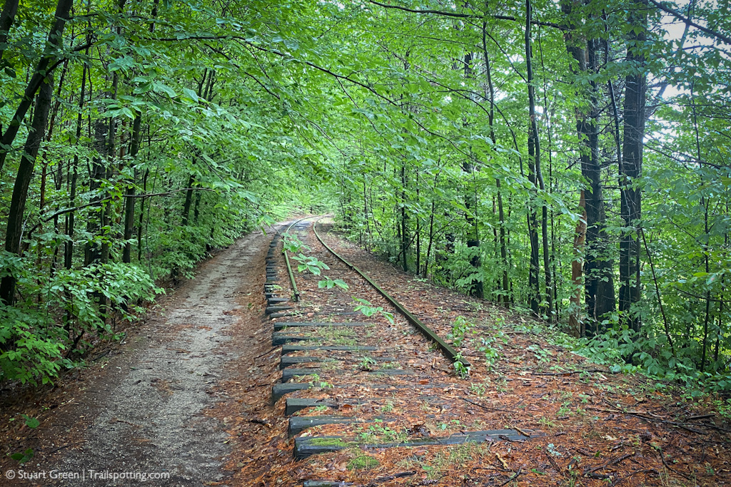
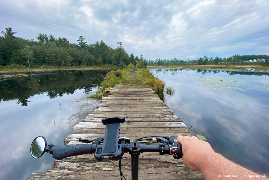
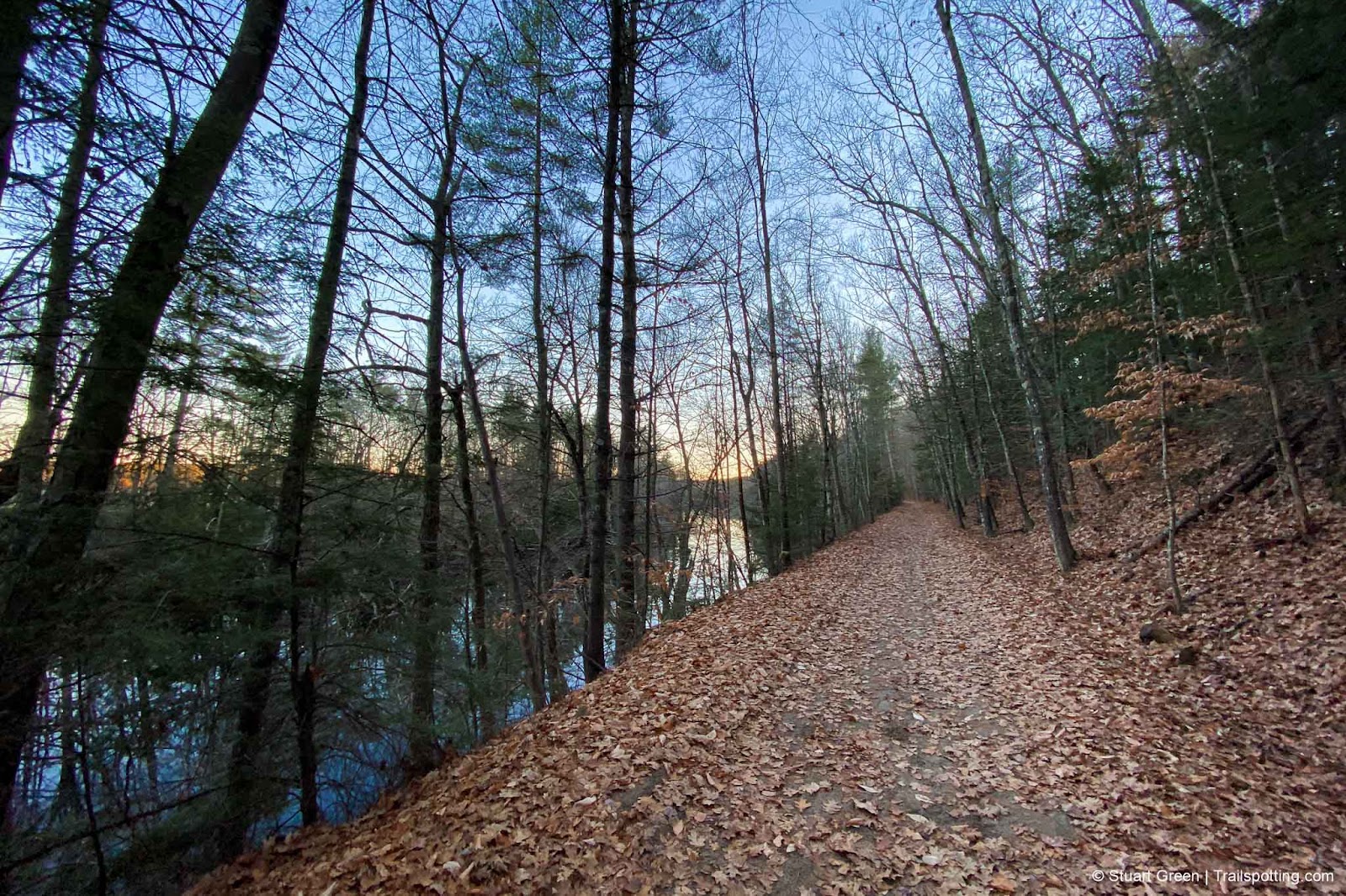
Please be mindful that trail conditions can vary significantly from smooth asphalt paving to unimproved rough surfaces. Check our individual trail reviews for more information. Walking along any existing railroad track is dangerous and also illegal, including track that you may think is inactive. Please stay on the trail, as many rail trail segments cross private property; and always be respectful of 'No Trespassing' signs posted by landowners.External Links
NH Rail Trail Coalition: Rail Trail ChallengeNew Hampshire Fire Towers
Discover our map of fire towers and the trails to find them.
Discover our map of fire towers and the trails to find them.
New Hampshire Covered Bridges
Maps, lists, directions and nearby trails to the state's covered bridges.
Maps, lists, directions and nearby trails to the state's covered bridges.
NH 52 With A View
Explore the best views in the White Mountains.
Explore the best views in the White Mountains.