
Rail Trails of Maine
We've built the first complete rail trail map of New England to help you plan your next outdoor adventure. Not only do we show all navigable rail trails, but we also show them in context with today's live rail network and also the long-gone routes of history. Our road biking and trail access connections also help with bicycle touring routes.
See these links for other areas:
Beyond this map we also have individual rail trail reviews. These trail reviews include photography and even more detailed maps that show trail surface conditions and points of interest along the route.
Maine Rail Trails
4-Star Trails

Eastern Promenade 4★
1.5 mi · Good · 40ft (30ft)
1.5 mi · Good · 40ft (30ft)
2-Star Trails

Bayside 2★
0.9 mi · Good· 20ft (20ft)
0.9 mi · Good· 20ft (20ft)
Yet To Review

Aroostook Valley
51.4 mi · 840ft (1140ft)
51.4 mi · 840ft (1140ft)
Aroostook Valley Caribou
6.4 mi · 70ft (180ft)
6.4 mi · 70ft (180ft)
Bangor & Aroostook
46.4 mi · 930ft (880ft)
46.4 mi · 930ft (880ft)
Bangor & Aroostook Caribou
15.8 mi · 340ft (512ft)
15.8 mi · 340ft (512ft)
Belfast
2.2 mi · 60ft (70ft)
2.2 mi · 60ft (70ft)
Calais Waterfront Walkway
1.5 mi · 16ft (30ft)
1.5 mi · 16ft (30ft)
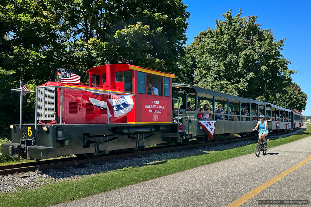
Carrabassett Narrow Gauge
4.9 mi · 26ft (400ft)
4.9 mi · 26ft (400ft)
Down East Sunrise
87.6 mi · 2290ft (2320ft)
87.6 mi · 2290ft (2320ft)
Ellsworth
0.6 mi · 10ft (10ft)
0.6 mi · 10ft (10ft)
Eastern Kennebunk-Biddeford
6.1 mi · 150ft (150ft)
6.1 mi · 150ft (150ft)
Eastern Old Orchard Beach
7.6 mi · 90ft (80ft)
7.6 mi · 90ft (80ft)
Eastern South Portland
3.5 mi · 50ft (80ft)
3.5 mi · 50ft (80ft)
Fairfield Rotary Centennial
1.3 mi · 60ft (80ft)
1.3 mi · 60ft (80ft)
Four Seasons Adventure
29.5 mi · 500ft (840ft)
29.5 mi · 500ft (840ft)
Gardiner Old Narrow Gauge
1.3 mi · 140ft (130ft)
1.3 mi · 140ft (130ft)
Gorham Cross Town
1.5 mi · 10ft (70ft)
1.5 mi · 10ft (70ft)
Hancock Old Pond Railway
2.7 mi · 90ft (100ft)
2.7 mi · 90ft (100ft)
Kennebec River
6 mi · 170ft (180ft)
6 mi · 170ft (180ft)
Kennebec Valley
14.6 mi · 360ft (380ft)
14.6 mi · 360ft (380ft)
Lagrange-Medford
11 mi · 190ft (280ft)
11 mi · 190ft (280ft)
Lisbon Rail Trail
1.4 mi · 60ft (80ft)
1.4 mi · 60ft (80ft)
MDT Fryeburg Bike Path
3.9 mi · 60ft (130ft)
3.9 mi · 60ft (130ft)
MDT Otter Ponds
4.6 mi · 170ft (310ft)
4.6 mi · 170ft (310ft)
MDT South Windham-Westbrook
5 mi · 180ft (190ft)
5 mi · 180ft (190ft)
Norway
0.6 mi · 20ft (0ft)
0.6 mi · 20ft (0ft)
Patten
5.5 mi · 70ft (140ft)
5.5 mi · 70ft (140ft)
Old Veazie Railroad
7.4 mi · 100ft (140ft)
7.4 mi · 100ft (140ft)
Pittsfield
1.4 mi · 20ft (40ft)
1.4 mi · 20ft (40ft)
Riverton
0.6 mi · 40ft (0ft)
0.6 mi · 40ft (0ft)
Sanford-Springvale
6 mi · 190ft (240ft)
6 mi · 190ft (240ft)
Sipayik
1.9 mi · 40ft (50ft)
1.9 mi · 40ft (50ft)
Southern Bangor & Aroostook
37.5 mi · 700ft (900ft)
37.5 mi · 700ft (900ft)
St John Valley Heritage
16.9 mi · 340ft (460ft)
16.9 mi · 340ft (460ft)
Stillwater
1.6 mi · 50ft (60ft)
1.6 mi · 50ft (60ft)
Whistle Stop
15.2 mi · 500ft (520ft)
15.2 mi · 500ft (520ft)
Definitions
• Good - Asphalt or hardpack trail conditions• OK - Occasionally rough surface
• Rough - Mountain bikes and hiking recommended
• Measurement of feet represent total elevation gain when cycling from west to east or north to south. Numbers in parentheses represent elevation gain in opposite direction.
Explore Responsibly
Please be mindful that trail conditions can vary significantly from smooth asphalt paving to unimproved rough surfaces. Check our individual trail reviews for more information. Walking along any existing railroad track is dangerous and also illegal, including track that you may think is inactive. Please stay on the trail, as many rail trail segments cross private property; and always be respectful of 'No Trespassing' signs posted by landowners.External Links
• Facebook Group: Comment, Follow Us
New England Fire Towers
Discover our map of fire towers and the trails to find them.
Discover our map of fire towers and the trails to find them.

New England Covered Bridges
Maps, lists, directions and nearby trails to New England's covered bridges.
Maps, lists, directions and nearby trails to New England's covered bridges.

New England Summits
Explore mountain-top hikes around New England with Trailspotting.
Explore mountain-top hikes around New England with Trailspotting.