Follow for new reviews:

Covered Bridges of New Hampshire

.


We've mapped the state's covered bridges to help us locate them on our explorations and we hope this will help you too. Below the map we've included a list of all covered bridges, which include Google Map navigation links (click the name of the bridge to launch navigation). We also include links to trails that use covered bridges and other nearby hikes and rail trails.

Note that we've not yet visited all bridges on this list and cannot confirm whether they're publically accessible, to please take precautions to identify private property and heed any no trespassing signs.

Covered Bridge List:
Bridge (with directions)LatLonTrailspotting
Albany44.0057958-71.2407308
Ashuelot42.7771197-72.4233424
Bartlett44.0950449-71.2035224
Bath44.1668218-71.9671336
Bement43.2641365-71.9531438
Blacksmith Shop43.4629715-72.3534397
Blair43.8103153-71.6656154
Blow-Me-Down43.5172948-72.3739184
Brundage43.6068207-71.9388216
Bump43.8145763-71.6217136
Carlton42.8546762-72.274433
Chester42.9816642-71.2160863
Cilleyville43.430423-71.8689848
Clark's44.0515486-71.6877924
Columbia44.8531156-71.5516276
Contoocook RR43.2230998-71.7138691Trail
Coombs42.8379456-72.3609493
Corbin43.3910581-72.1954114
Cornish-Windsor43.473704-72.3840408
Dalton43.2769639-71.8112835Trail
Denman Thompson42.8719281-72.3279481
Dingleton Hill43.4644321-72.3692562
Durgin43.8558514-71.3643524
Edgell43.8678434-72.1646402
Flume44.0993504-71.6769584Trail
Groveton44.5956099-71.5105265
Hancock-Greenfield42.956729-71.9348291Near
Happy Corner Bridge45.0844904-71.3134108
Haverhill-Bath44.154665-72.0363631
Honeymoon44.1415927-71.1862816
HoodKroft42.8881648-71.313469
Jack O'Lantern43.9493141-71.6769341
Keniston43.4350086-71.8360913
McDermott43.1697356-72.3458045
Mechanic St44.4869082-71.5642105
Meriden43.5534504-72.2658563
Merrimack42.8962186-71.5635822
Mount Orne44.4601941-71.6528186
New England College43.1774462-71.8241953Trail
Nissitissit Bridge42.7354509-71.6707485Trail
Old Stage Rd42.9424039-70.8774795
Packard Hill43.6386307-72.2224272
Pier43.3619613-72.2409491Trail
Pittsburg-Clarksville45.0544807-71.4068436
Prentiss43.1531309-72.3933557
River Road45.072546-71.3059107
Riverwalk44.3058618-71.7732247
Rowell43.1926581-71.7487978Trail
Saco River43.9830335-71.1170615
Sawyers Crossing42.8862357-72.2865475
Sentinel Pine44.1043026-71.6779955Trail
Slate42.8472948-72.340412
Smith43.7752685-71.7389933Near
Squam River43.718816-71.6189373Near, Near
Stark44.6010108-71.4081328
Sugar River43.38588-72.08286Trail
Sulphite RR43.445-71.635278Trail
Swift River43.9848177-71.1193909
Swiftwater44.1338533-71.9508216
Tannery Hill43.5495911-71.4053652
Waterloo43.2880425-71.8562206
Wentworth43.8683062-71.9090248
Whittier43.8221075-71.2118564
Wright's43.3589353-72.2591038Trail

Excluded List:
Bridge (with directions)LatLonTrailspotting
Allen Hollis44.037859-71.783423
Chocorua Ski & Beach43.85492-71.204036
Little Red Bridge43.0448422-71.3149056
Melendy Pond42.7612384-71.4291975
Nepalese 44.37776-71.2802786
Plaistow Town Forest42.86622-71.13363Trail
Royal Crest Covered 42.71231-71.44818
Teixeira Park42.8882166-71.9776153
Yankee Barn43.5267571-72.1253745

Tangents:
• Trailspotting: NH Trails with Covered Bridges
• Trailspotting: Download Covered Bridge map as KML file
• External Links: 
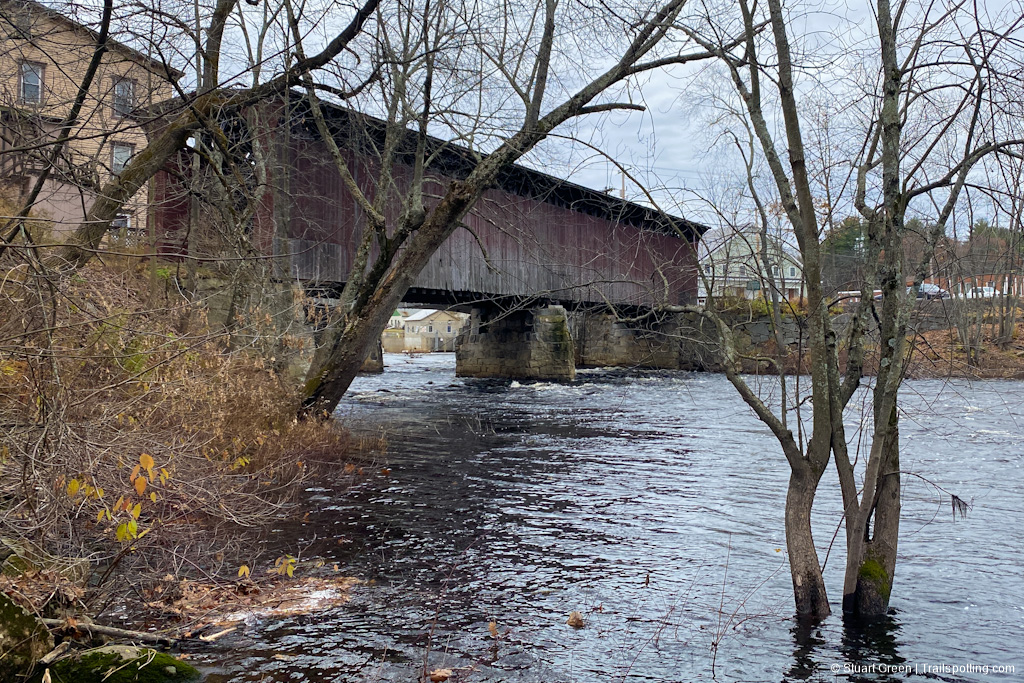
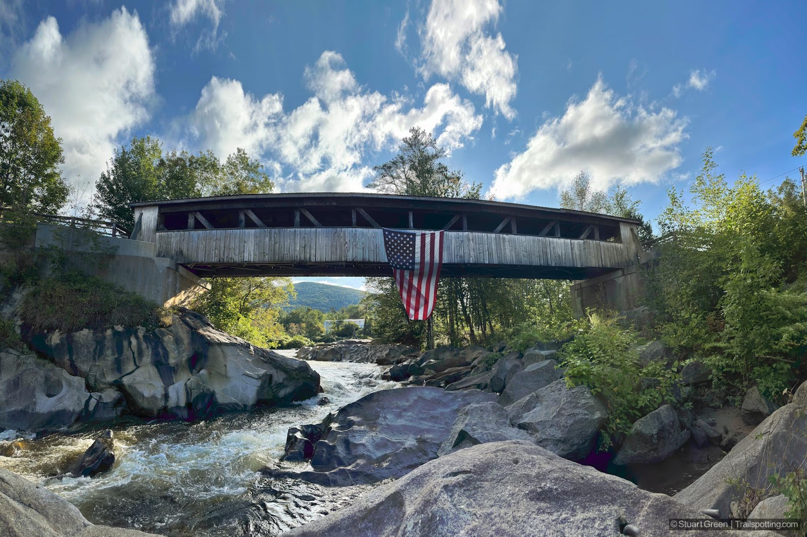
New Hampshire Covered Bridges on Wikipedia
• Facebook Group: Comment on this article
Follow for new reviews:


More Trailspottng:
Hiking · Rail Trails · California · Hawaii · New Hampshire · Massachusetts · Southwest US · Vermont

All content copyright © 2005-2023 Stuart Green. Presented with no advertising or affiliate links. Information on this site is provided without warranty. Users are responsible for their own actions and for validating all information.