
Eastern Promenade Trail, Portland ME
• 2 & 4-star trails
• 2 miles each way
• Easy | Low gradient
• Portland, ME | Maine
.
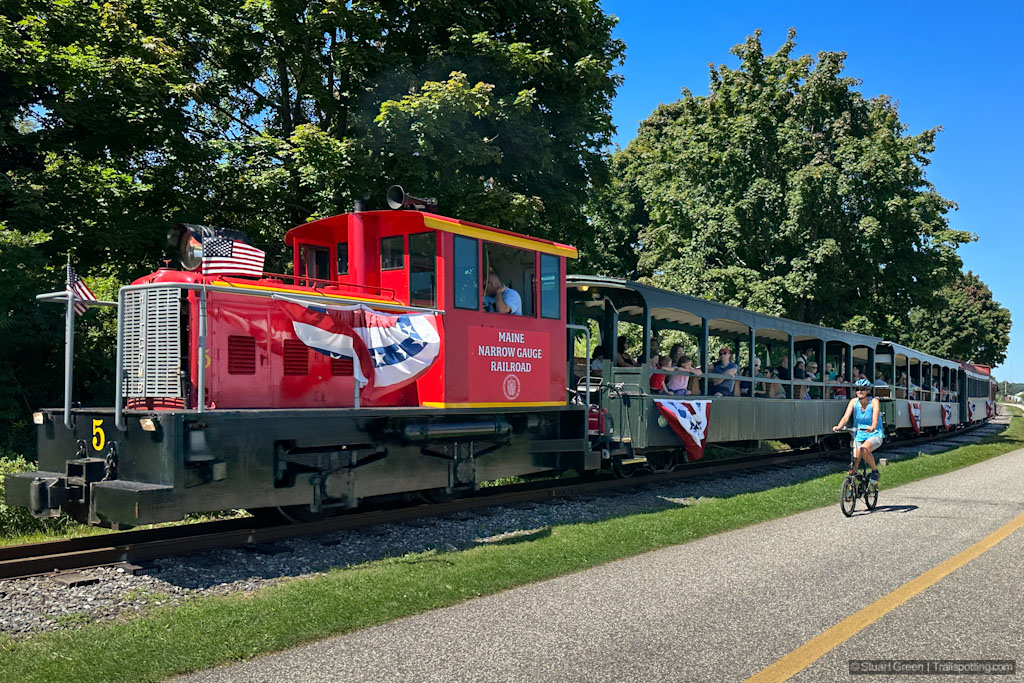
Sharing the trail with the Maine Narrow Gauge Railroad.
The railroad arrived in Portland in 1842, moving agricultural goods onto ships bound for Europe and ferrying passengers as far as Boston - which was served by six trains each day. Portland even boasted four passenger railroad stations and a locomotive works. Thanks to the Maine Narrow Gauge Railroad trains still power around the city's Eastern Promenade today, though only running a one-and-a-half mile out-and-back service for sightseers.
Hopping on the train in downtown is a great way to see the views of the Eastern Promenade, but if you're looking for some exercise or want to explore Portland's peninsula at your own pace, then the paved pedestrian and bicycle trails that run parallel to the narrow gauge railroad tracks are a great option.
| 1
4★ Eastern Promenade Trail
GPX File · AllTrails · Directions GPX? |
| 2
2★ Bayside Trail
GPX File · AllTrails · Directions |
| P Free parking |
1 Eastern Promenade Trail
Enjoy the sea breezes along this smooth and mostly flat coastal trail that suitable for all ages. Bordered by green parkland and greeting you with wide views of Casco Bay, from here you can also access the East End Beach or rent a kayak from the Eastern Promenade Beach. The trail continues beyond the length of the railway tracks until you reach Tukey's Bridge. From here you can pick up the Bayside Trail and return towards town, or continue on the 3.6 mile full-circuit Back Cove Trail.
2 Bayside Trail
Located between Portland and Interstate 295 the Bayside Trail doesn't have much to offer by way of views, and aside from terminating a couple of blocks from Deering Oaks Park it doesn't take you anywhere interesting. The trail leads through commercial buildings and parking lots and includes several road crossings. It's always great to see car-free trails for pedestrians and bicyclists, but this one doesn't offer much for sightseers.
⚠ Trail Conditions: Smooth asphalt trails, often with separated bicycle and pedestrian traffic. Mostly flat but with some gradient near Tukey's Bridge.

Casco Bay views, and the East End Rail Bridge.

Separate trails for pedestrians, cyclists and locomotives!

A surviving Portland Company works building close to town.
Tangents:
• Official Link: Eastern Promenade Trail
• Facebook Group: Comment, Follow Us
Rail Trail Map of New England
Every rail trail, with links to our reviews, photos & detailed route maps.
Every rail trail, with links to our reviews, photos & detailed route maps.

New England Fire Towers
Discover our map of fire towers and the trails to find them.
Discover our map of fire towers and the trails to find them.

New England Covered Bridges
Maps, lists, directions and nearby trails to New England's covered bridges.
Maps, lists, directions and nearby trails to New England's covered bridges.