
Barker Dam Nature Trail, Joshua Tree CA
• 3-hike
• 1 mile loop
• Easy | Gain 70 feet
• Twentynine Palms, CA | Joshua Tree
.

The Barker Dam Nature Trail offers an excellent introduction to Joshua Tree National Park, covering 1.3 miles in an easy loop that takes most visitors 30-45 minutes. The trail pairs well with the neighboring Wall Street Mill Trail for a half-day exploration of the area's natural and historical features. Most of the path follows solid sandy ground with a few short rock scrambling sections that present minimal challenge for most people.
The trail winds through classic Joshua Tree landscape, passing between massive weathered granite boulders and diverse desert vegetation. Joshua trees, junipers, and various cacti line the route as it leads toward lower-lying ground where Barker Dam sits. Built in the early 1900s by cattlemen including C.O. Barker, the dam created a small reservoir that supplied water for cattle operations and nearby mining activities. Today when water levels are adequate, typically after winter rains, the reservoir attracts wildlife and creates a rare desert oasis.
| ⬤
4★ Barker Dam Nature Trail
GPX File · AllTrails · Directions GPX? |
| $ NPS entrance fee |
Rather than backtracking, continue on the loop for more varied terrain and excellent interpretive signage. The nature trail features some of the park's best educational signs, covering topics from geology to plant adaptations. One sign highlights the cheesebush, a small shrub whose leaves emit a distinctive cheese-like odor when crushed—worth stopping to experience this unusual desert plant firsthand.
On the southwestern section of the loop, past the main junction, you'll find ancient petroglyphs etched into the rock face. An interpretive sign marks the location, making it easy to spot. These Native American rock art images date back hundreds of years and were created by the Serrano and Cahuilla peoples who inhabited the area.
The trailhead is located off Park Boulevard in the Hidden Valley area, accessible via a short spur road. The parking lot accommodates roughly 30 vehicles but fills quickly during peak visitation periods from October through April. Arriving early morning provides the best chance for parking and opportunities to spot wildlife near the dam.

Barker dam, mostly devoid of water.

Be sure to read the great interpretative signs on this nature trail.
Tangents:
• Official: Joshua Tree National Park
• AllTrails Public: Barker Dam Trail
• Facebook Group: Comment, Follow Us


LA's Best Trails
Explore the natural side of Los Angeles with Trailspotting's Best Trails feature.
Explore the natural side of Los Angeles with Trailspotting's Best Trails feature.
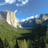
Yosemite's Best Trails
Epic scenery and adventures await. Summit hikes, waterfalls and more to choose from.
Epic scenery and adventures await. Summit hikes, waterfalls and more to choose from.