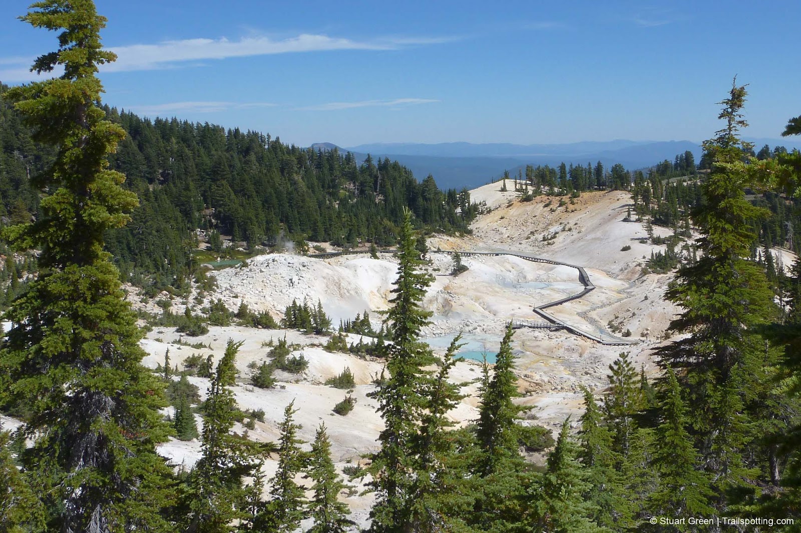
Bumpass Hell, Lassen National Park CA
• 5-star hike
• 2 mile out-and-back
• Easy | Gain 410 ft | Peak 8,400 ft
• Mineral, CA | Lassen Region
.

Visitors on the boardwalk at Bumpass Hell.
Sticking to the trail is always recommended, but if you're visiting Bumpass Hell we really must insist. To illustrate the point you have to look no further than the man who discovered these volcanic hotsprings, Kendal Bumpass, who managed to fall in and injure his leg not once but twice, the second time requiring his leg to be amputated!
No such fate is likely to befall you these days, thanks to a network of sturdy boardwalks guiding you over and around the boiling pools of water, bubbling mud pots and fuming sulfuric vents. In fact, the trail to the hotsprings is ideally accessible for almost everyone - it's mostly level and well maintained, with great opportunities for southerly mountain views as it winds around the side of a hill before descending no more than a couple of hundred feet to the hotsprings.
| ⬤ 4★ Bumpass Hell Trail
GPX File · AllTrails · Directions GPX? |
| $ NPS entrance fee |
This also makes it the most popular hike in the park, so you might want to get there early if you want to avoid the crowds. Also, this trail begins just across the road from the trailhead to Lassen Peak, so you could easily bag both trails in a single day if you chose to do so.
Snow covers the Lassen landscape for much of the year and some roads and trails may not be open - even in summer. Check the links below to find updated information on road closures, trail closures and campground status.

Admiring a distant Brokeoff Mountain from the Bumpass trail.

Surveying Bumpass Hell from above.
Tangents:
• Official: Lassen Volcanic NP
• AllTrails Public: Bumpass Hell
• Facebook Group: Comment, Follow Us

Trailspotting Nearby
5★ Lassen Peak (4 mi) ·
5★ Brokeoff Mountain (7 mi) ·
4★ Cluster Lakes (11 mi) ·
Show Map

Lassen Volcanic National Park
The park's Best Hikes include every type of volcano!
The park's Best Hikes include every type of volcano!

Best Trails of California
See our favorite hiking trails for each region of California.
See our favorite hiking trails for each region of California.


