Posts
Showing posts with the label hard
Middleton Rail Trails, MA
• 3 & 4-star trails
• 2.2 to 7.5 miles each way
• Easy/Hard difficulty | Easy elevation
• Middleton to Danvers, MA | NE Massachusetts
…
• 2.2 to 7.5 miles each way
• Easy/Hard difficulty | Easy elevation
• Middleton to Danvers, MA | NE Massachusetts
…
Mount Hancock, Lincoln NH
• 3-star hike
• 9.0 mile out-and-back
• Medium/Hard difficulty | Gain 2,600 feet
• Lincoln, NH | White Mountains
…
• 9.0 mile out-and-back
• Medium/Hard difficulty | Gain 2,600 feet
• Lincoln, NH | White Mountains
…
Mt Jefferson Caps Ridge, NH
• 5-star hike
• 4.5 mile out-and-back
• Medium/Hard difficulty | Gain 2,670 feet
• Bowman, NH | White Mountains
…
• 4.5 mile out-and-back
• Medium/Hard difficulty | Gain 2,670 feet
• Bowman, NH | White Mountains
…
Sugar River Rail Trail & Bobby Woodman, NH
• 5-star trail
• 9.5 to 11.3 miles each way
• Medium - Hard difficulty | Moderate elevation
• Newport - Claremont, NH | Sunapee Region
…
• 9.5 to 11.3 miles each way
• Medium - Hard difficulty | Moderate elevation
• Newport - Claremont, NH | Sunapee Region
…
Mt Washington, Tuckerman Ravine NH
• 4-star hike
• 7.8 mile part-loop
• Hard difficulty | Gain 4,200 ft (Peak 6,288 ft)
• Mt Washington State Park | White Mountains
…
• 7.8 mile part-loop
• Hard difficulty | Gain 4,200 ft (Peak 6,288 ft)
• Mt Washington State Park | White Mountains
…
Fisher Mountain, Thornton NH
• 4-star hike
• 3.8 mile out-and-back
• Hard difficulty | Gain 1,335 feet
• Thornton, NH | White Mountains
…
• 3.8 mile out-and-back
• Hard difficulty | Gain 1,335 feet
• Thornton, NH | White Mountains
…
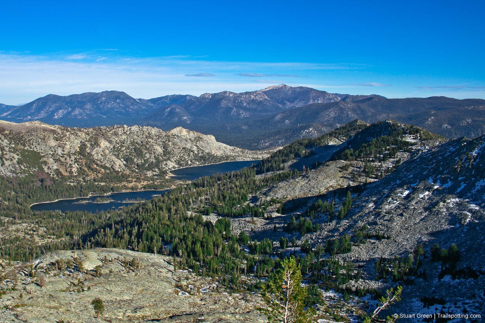
Mt Eddy & Dead Fall Lakes CA
• 5-star hike
• 10.2 mile out-and-back
• Medium difficulty | Gain 2,215 ft (Peak 9,025 ft)
• Weed, CA | Shasta-Trinity Region
…
• 10.2 mile out-and-back
• Medium difficulty | Gain 2,215 ft (Peak 9,025 ft)
• Weed, CA | Shasta-Trinity Region
…
Sonora Peak CA
• 4-star hike
• 4.0 mile out-and-back
• Hard difficulty | Gain 1,980 ft (Peak 11,431 ft)
• Sonora Pass, CA
…
• 4.0 mile out-and-back
• Hard difficulty | Gain 1,980 ft (Peak 11,431 ft)
• Sonora Pass, CA
…
Mount Dana, Yosemite CA
• 5-star hike
• 4.9 mile out-and-back
• Hard difficulty | Gain 3,070 ft (Peak 13,053 ft)
• Lee Vining, CA | Yosemite National Park
…
• 4.9 mile out-and-back
• Hard difficulty | Gain 3,070 ft (Peak 13,053 ft)
• Lee Vining, CA | Yosemite National Park
…
Half Dome, Yosemite CA
• 5-star hike
• 15.5 mile out-and-back
• Hard difficulty | Gain 4,800 ft (Peak 8,836 ft)
• Yosemite, CA | Yosemite National Park
…
• 15.5 mile out-and-back
• Hard difficulty | Gain 4,800 ft (Peak 8,836 ft)
• Yosemite, CA | Yosemite National Park
…
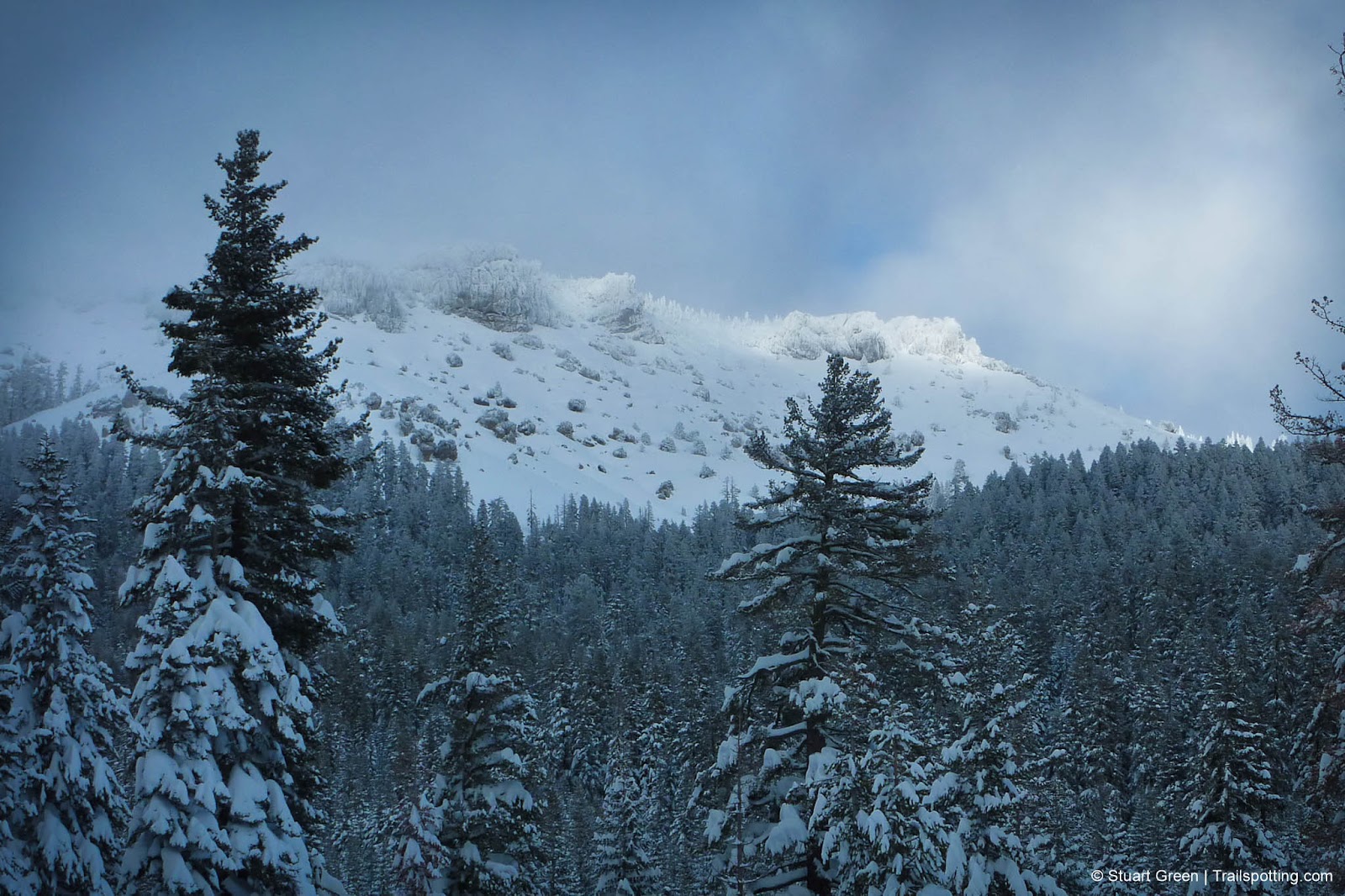
Castle Peak, Tahoe National Forest CA
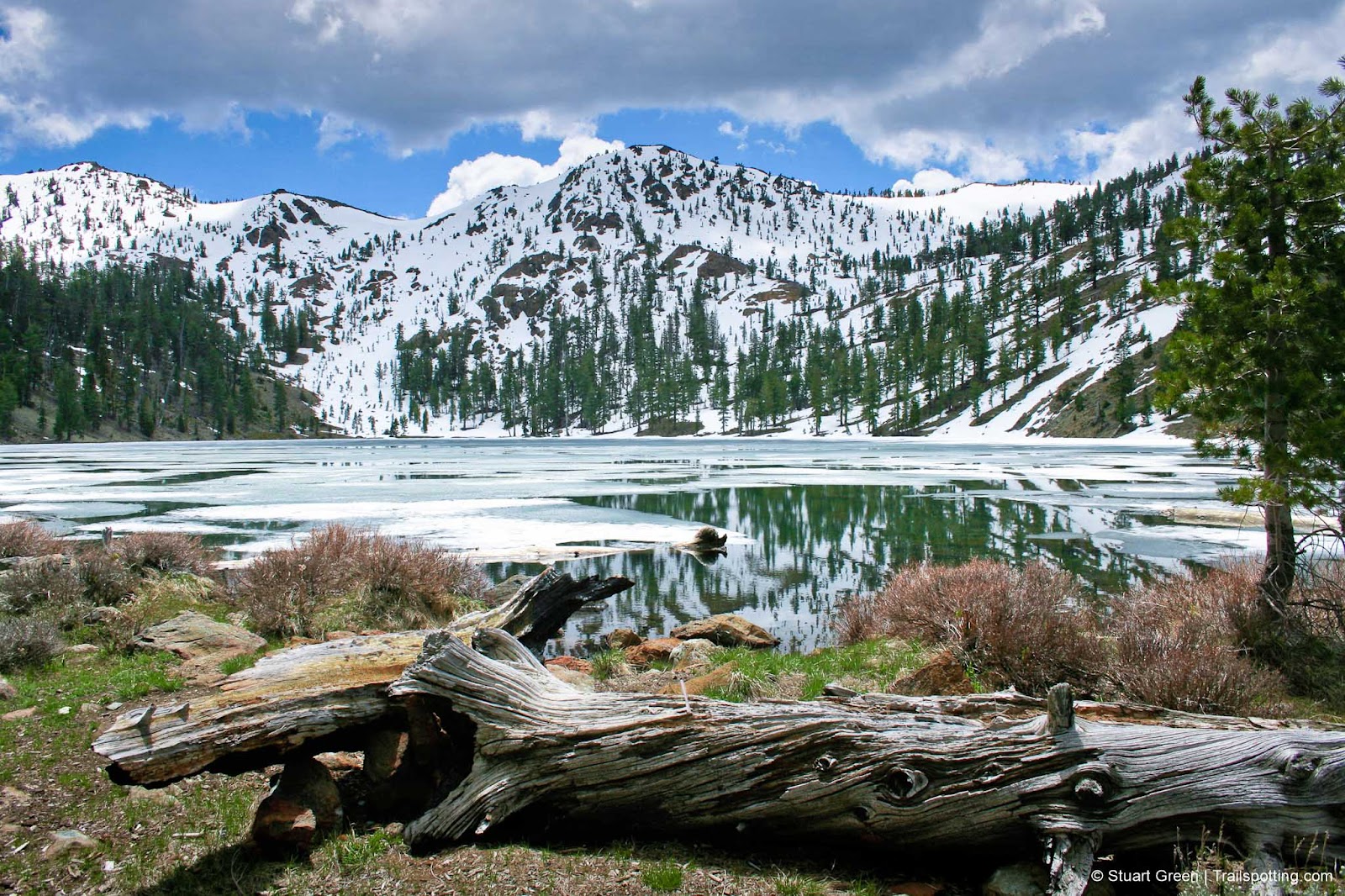
• 5-star hike
• 5.4 mile out-and-back
• Hard difficulty | Gain 1,670 feet (Peak 9,103 feet)
• Donner Summit, CA | Lake Tahoe
…
• 5.4 mile out-and-back
• Hard difficulty | Gain 1,670 feet (Peak 9,103 feet)
• Donner Summit, CA | Lake Tahoe
…
Mount Ralston, CA
• 3-star hike
• 6.6 mile out-and-back
• Hard difficulty | Gain 2,730 feet (Peak 9,235 feet)
• Twin Bridges, CA | Lake Tahoe
…
• 6.6 mile out-and-back
• Hard difficulty | Gain 2,730 feet (Peak 9,235 feet)
• Twin Bridges, CA | Lake Tahoe
…
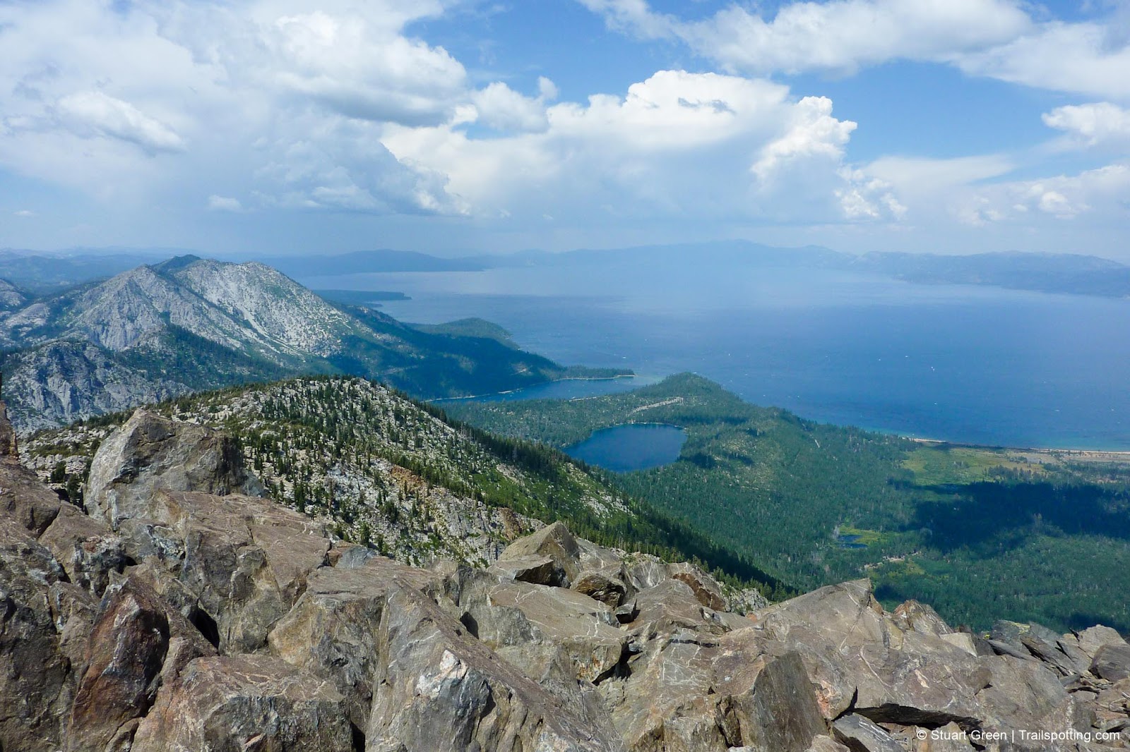
Mount Tallac, Lake Tahoe CA
• 5-star hike
• 8.9 mile out-and-back
• Hard difficulty | Gain 3,260 feet (Peak 9,735 feet)
• Meyers, CA | Lake Tahoe
…
• 8.9 mile out-and-back
• Hard difficulty | Gain 3,260 feet (Peak 9,735 feet)
• Meyers, CA | Lake Tahoe
…
Follow for new reviews:

More Trailspottng:
Hiking ·
Rail Trails ·
Fire Towers ·
Covered Bridges ·
Gear ·
California ·
Hawaii ·
New Hampshire ·
Massachusetts ·
Southwest US ·
Vermont
All content copyright © 2005-2023 Stuart Green. Presented free of advertising. Information on this site is provided without warranty. Users are responsible for their own actions and for validating all information.


More Trailspottng:
All content copyright © 2005-2023 Stuart Green. Presented free of advertising. Information on this site is provided without warranty. Users are responsible for their own actions and for validating all information.