
Mt Eddy & Dead Fall Lakes CA
• 5-star hike
• 10 mile out-and-back
• Moderate | Gain 2,220 ft | Peak 9,025 ft
• Weed, CA | Shasta-Trinity Region
.
Mount Eddy might be the highest peak in the Klamath Mountains but barely anyone notices it, since it's overshadowed by Mount Shasta, a staggering five thousand feet taller. Overshadowed though it may be, the scenery, solitude and variety of the wilderness around Mount Eddy should not be overlooked.
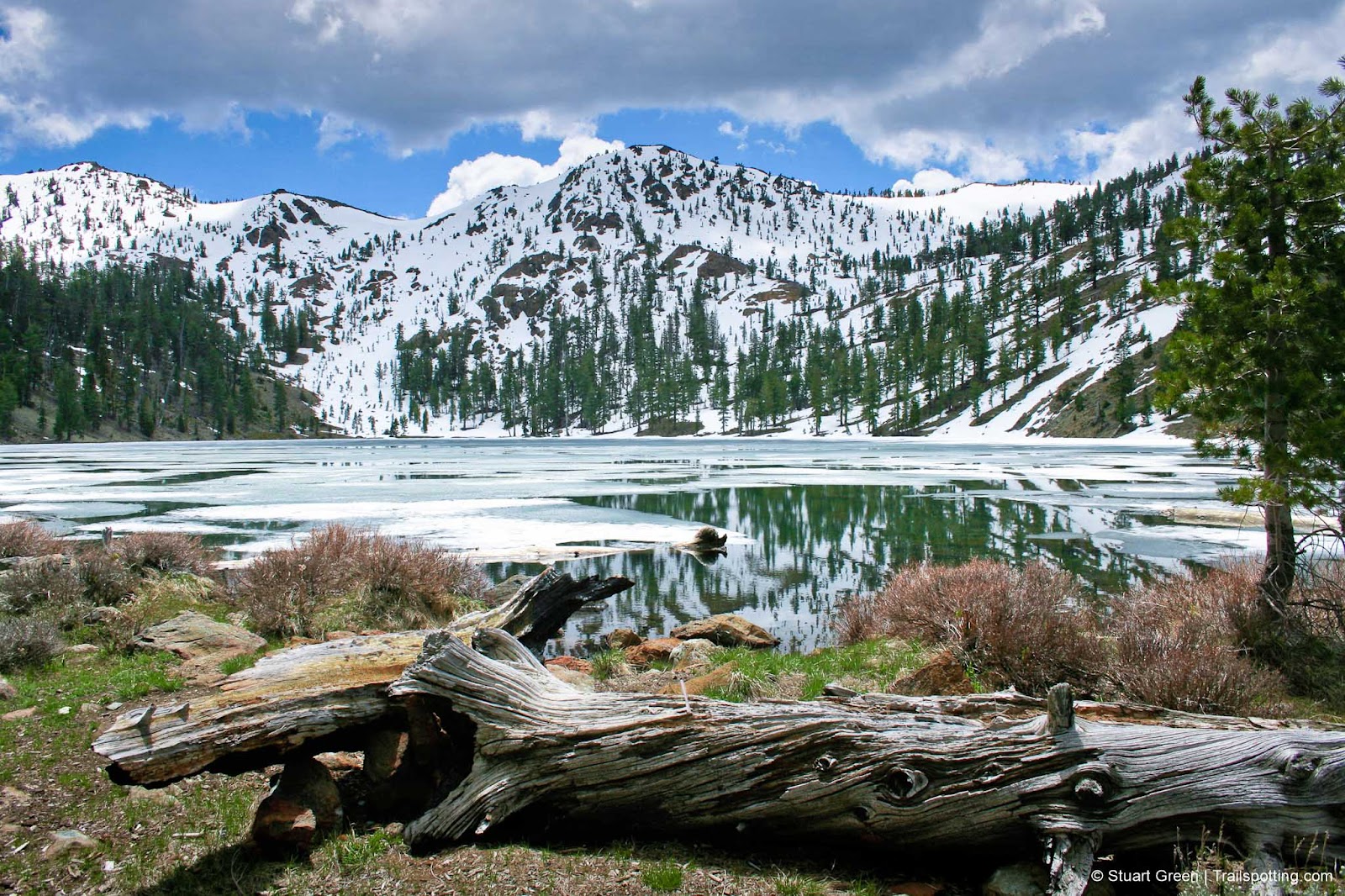
The Dead Fall Lakes lie in a bowl almost entirely ringed by mountain peaks, which is where the first half of this hike takes us. The lakes are reason enough to put on your hiking boots even if you don't plan on a Mount Eddy summit, and are often a destination for backpacking campers.
Begin at the trailhead on the single-track route which initially runs parallel to the road, labelled with a Pacific Crest Trail (PCT) sign (ignore the wider faint fire road at the trailhead). There's only 400ft elevation gain to the Dead Fall lakes, meaning you can put more effort into admiring the wide landscape vistas over the nearby terrain and the more distant Trinity Alps to the South West.
| ⬤
5★ Mt Eddy & Dead Fall Lakes
GPX File · AllTrails · Directions GPX? |
| P Free parking |
Three miles into the hike you'll reach the lakes and the point where you'll decide whether to tackle the extra two-and-a-half miles and 1800ft elevation gain to the top of Mount Eddy. The summit trail is a relatively pleasant uphill walk, rarely rocky, and with switchbacks making the final part of the climb as straightforward as the rest. Views from the top are superb, including first and only views of Mt. Shasta from the trail.
We hiked this route at the end of May. Snow on Parks Creek Rd usually makes the trailhead inaccessible before this time, and driving on the snow is highly inadvisable due to chances of getting stranded in such a remote location. We recommend that you use either your GPS or your vehicle's trip counter to judge your location on the road, so if snow blocks your path you'll know whether it's feasible to park up and hike the rest of the way to the trailhead.
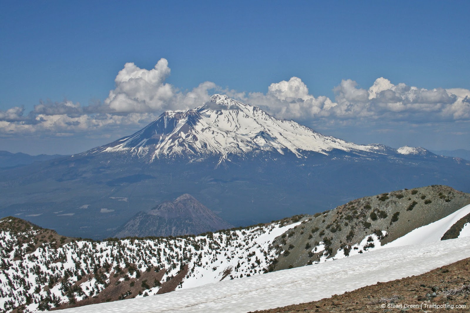
Summit views from Mount Eddy
Tangents:
• Official: Forest Service
• AllTrails Public: Mt Eddy
• Facebook Group: Comment, Follow Us

Best Trails of California
See our favorite hiking trails for each region of California.
See our favorite hiking trails for each region of California.

Lassen Volcanic National Park
The park's Best Hikes include every type of volcano!
The park's Best Hikes include every type of volcano!

California Lakes
Reflecting on lake-side and lake-view hikes.
Reflecting on lake-side and lake-view hikes.