
Cinder Cone, Lassen National Park CA
• 5-star hikes
• 3 to 5 mile options
• Moderate | Gain 730 to 1,120 ft | Peak 6,820 ft
• Mineral, CA | Lassen Region
.

Looking into the Lassen Cinder Cone.
Cinder cones are scattered all around you at Lassen Volcanic National Park. Some are in plain sight and others are overgrown and hidden by forest, but none are more recent and more spectacular than the Cinder Cone that created the Fantastic Lava Beds and the colorful Painted Dunes eleven miles north east of Lassen Peak.
Sometime around the middle of the seventeenth century a volcanic vent in this area began to expel small chunks of lava, which cooled in mid-air and fell back to earth to collect into a cone some 700 feet in height. Activity finally ceased when larger amounts of lava flowed up to the surface and eventually blocked the vent.
| ⬤ 5★ Cinder Cone Part Loop
GPX File · AllTrails · Directions GPX? |
| ⬤
5★ Cinder Cone Shortest Route
GPX File · AllTrails · Directions |
| $ NPS entrance fee* |
The hike from Butte Lake campground takes a route along the side of the lava beds and through a thin forest of evergreens before ascending the cinder cone. Although the route up the north face of the cone is well used, the ground underfoot is still loose, feeling much like walking along a mile of sandy beach, albeit at a thirty degree angle. From the summit you should take the time marvel at the Fantastic Lava Beds and Painted Dunes below you and the great mountain views of Lassen, Brokeoff and Chaos Crags.
Though geographically only eleven miles from Lassen Peak, Cinder Cone's Butte Lake trailhead is a 32 mile drive from the park's northern entrance and a fifty mile drive from Lassen Peak. We still recommend a visit however, particularly as you can stop by the Subway Caves lava tube on the way. Alternatively you can hike in from the park road if you start at Summit Lake, provided you're comfortable with a 17 mile out-and-back route with around 2,500 feet of elevation gain.
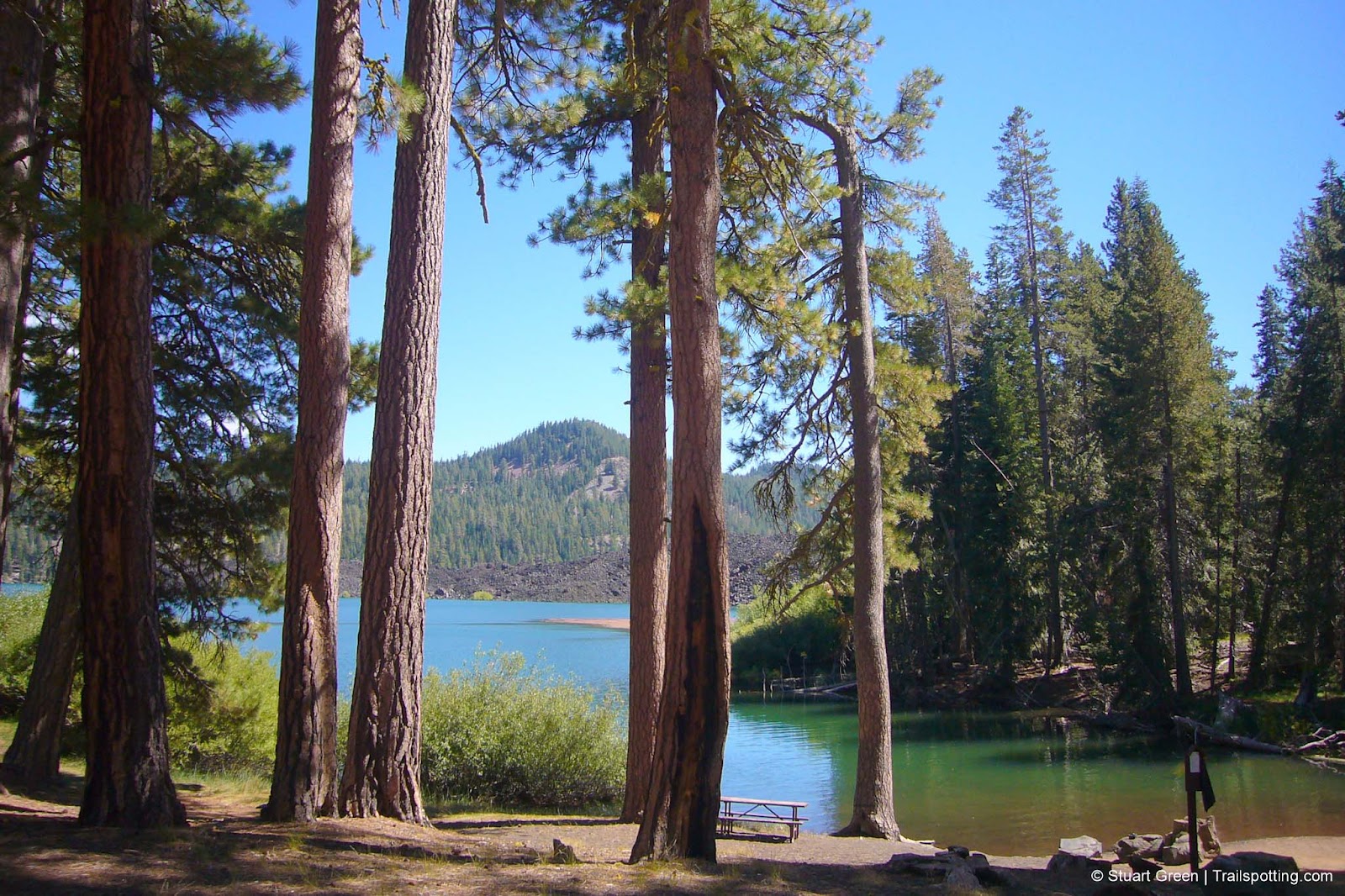
Butte Lake Trailhead.
To reaching the Butte Lake trailhead exit off Feather Lake Road (CA-44) and head south on the unpaved Butte Lake Road (NF32N21). We found the seven mile unpaved road to be entirely accessible by all types of vehicle in good conditions and the scenery along the route does a great job of distracting from the long drive.
Snow covers the Lassen landscape for much of the year and some roads and trails may not be open - even in summer. Check the links below to find updated information on road closures, trail closures and campground status.
* Though this hike is accessed from outside Lassen Volcanic National Park and does not require driving through an entry station. Since there is no requirement to display proof of payment on your parked vehicle or carry proof of payment with you within the park you could possibly complete this hike without paying the entry fee. However, we always pay the entrance fee or buy the interagency annual pass in support of the National Park Service and other government maintained lands.
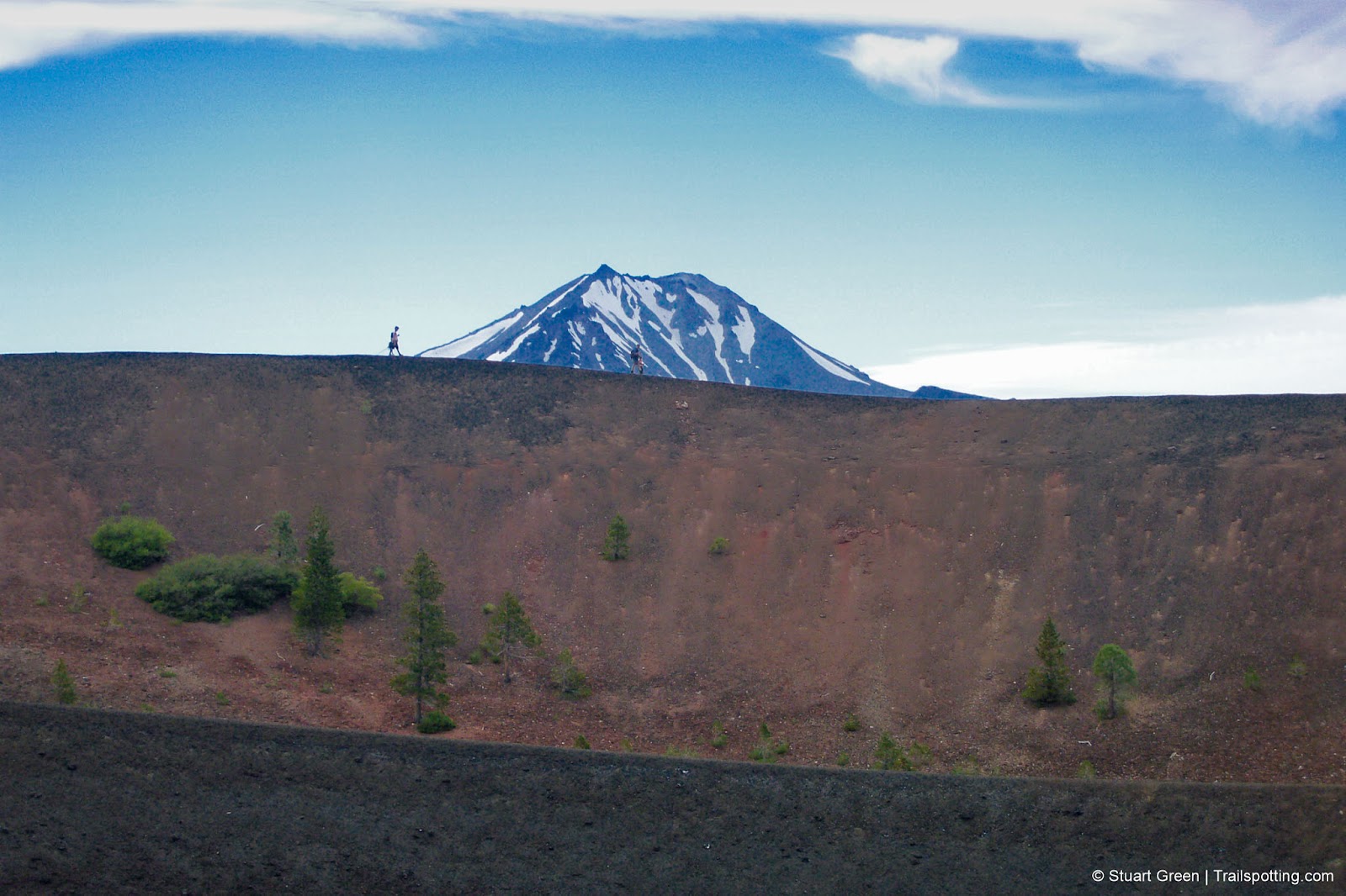
Hiking the Cinder Cone caldera, with a distant Lassen Peak.
Tangents:
• Official: Lassen Volcanic NP
• AllTrails Public: Cinder Cone
• Facebook Group: Comment, Follow Us


California Waterfalls
Trails to some of California's greatest waterfalls.
Trails to some of California's greatest waterfalls.

Best Trails of California
See our favorite hiking trails for each region of California.
See our favorite hiking trails for each region of California.