
Winnipesaukee River Rail Trail, NH
• 4-star trail
• 4.9 miles each way
• Easy difficulty | Easy - Moderate elevation
• Franklin - Tilton, NH | Lakes Region
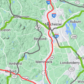
• Driving Directions: Marked ⬤ on map

Investigating the Sulphite "Upside Down" Bridge near Franklin, NH.
Trailspotting Rail Trail Map
NH's first complete rail trail map. With links to our reviews, photos & detailed route maps.
NH's first complete rail trail map. With links to our reviews, photos & detailed route maps.
Following the spectacular Winnipesaukee River and connecting the mill towns of Franklin and Tilton this mostly hard-pack trail is an excellent trip in either direction, visiting both towns and taking you past two separate historic bridges and a former freight depot on the route.
Around 130 feet of elevation gain separate the two towns. Although you'll hardly notice any incline on the rail trail, the difference is enough to bring river rafters and kayakers to tackle the river's curves and white water. Franklin is even developing New England's first white water park at Mill City Park, across the river from the trail's Western terminus.
Converting the 380 foot long Franklin Trestle Bridge to a footbridge is also part of the plans, but for the moment we have to admire it from below. Impressive as this trestle is, it's only the second of two impressive bridges neighboring this trail. The Sulphite Bridge, located a short distance down the trail is now on the National Register of Historic Places and is believed to be the only deck-covered railroad bridge remaining in the country. Regarded as an "upside down" covered bridge, the whole structure below the deck was originally walled-in with lumber to protect it from the elements.
 Asphalt,
  Hardpack,
  Road,
Road, Live Rail,
  No Access, Winnipesaukee River Rail Trail 4★
4.9 mi ea way, Easy, Elevation nominal.
Trailspotting Map: AllTrails, GPX File
The only paved part of the trail is a 0.4 mile segment near Franklin, between the two bridges, and requires short section of Easterly incline. Trail conditions beyond this are still good for road bikes and strollers however, and for most of its length the trail follows parallel to the old rails which are now being overtaken by trees and other vegetation.
The original trail ends in Tilton after 3.2 miles, but thanks to local efforts a further mile-long section of rail-with-trail has been completed beyond the East end of Tilton. At the moment, connecting these two segments require a three-quarter mile long road biking route along the quiet Elm Street and a short section on Route 132. Thankfully there's a sidewalk on Route 132 for those who prefer to walk, rather than ride along with traffic.
This extension beyond Tilton begins at a nice new parking lot by a railroad river bridge, crosses over the tracks at a grade crossing, then follows adjacent to the tracks for the rest of its length. A chainlink fence separates the trail from the live rail, and views towards the river that runs alongside the route involve occasional peeks through trees. There's a hotel and several businesses at the end of this extension, but no evident public parking opportunities.
Trail Conditions:
Mostly hardpack, short asphalt section at Franklin. OK for road bikes & strollers. Slopes down to the West, averaging 50ft/mile. Extension East of Tilton is flat, but connecting the trails requires 0.7 mi road biking.
Mostly hardpack, short asphalt section at Franklin. OK for road bikes & strollers. Slopes down to the West, averaging 50ft/mile. Extension East of Tilton is flat, but connecting the trails requires 0.7 mi road biking.

The trail runs alongside the now overgrown railroad lines.

Views through the Franklin Trestle Bridge | Mill wheel in Franklin's Trestle Park.

The river lapping up against the back of Tilton's Main Street.

Weathered sign hangs off the refurbished former Tilton freight depot.
Tangents:
• External Links: Public Map at AllTrails
• Facebook Group: Comment on this article
Nearby Trails:
• 1 mile away: Northern RT (5★ 58 mi)
• 3 miles away: Belmont Village Spur RT (2 mi)
• 5 miles away: WOW - Lake Winnisquam RTs (4★ 4 mi)
• Show on map: All nearby rail trails

NH Covered Bridges
Visit the Trailspotting NH Covered Bridge Map for all NH covered bridge locations and links to nearby trail reviews.
Visit the Trailspotting NH Covered Bridge Map for all NH covered bridge locations and links to nearby trail reviews.

Winnipesaukee Trail
The Winnipesaukee River Trail needs volunteers and donations to maintain and improve the trail.
The Winnipesaukee River Trail needs volunteers and donations to maintain and improve the trail.


