Posts
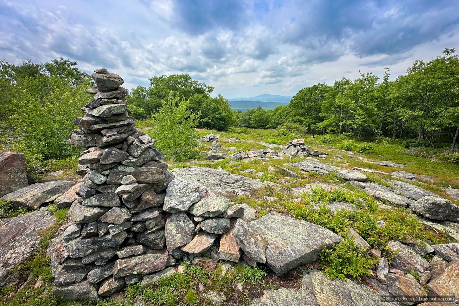
Pinnacle & Rose Mt, Lyndeborough NH
• 4-star hike
• 1.5 to 4.8 mile options
• Easy difficulty | Gain 450 to 820 feet
• Lyndeborough, NH | Monadnock Region
…
• 1.5 to 4.8 mile options
• Easy difficulty | Gain 450 to 820 feet
• Lyndeborough, NH | Monadnock Region
…
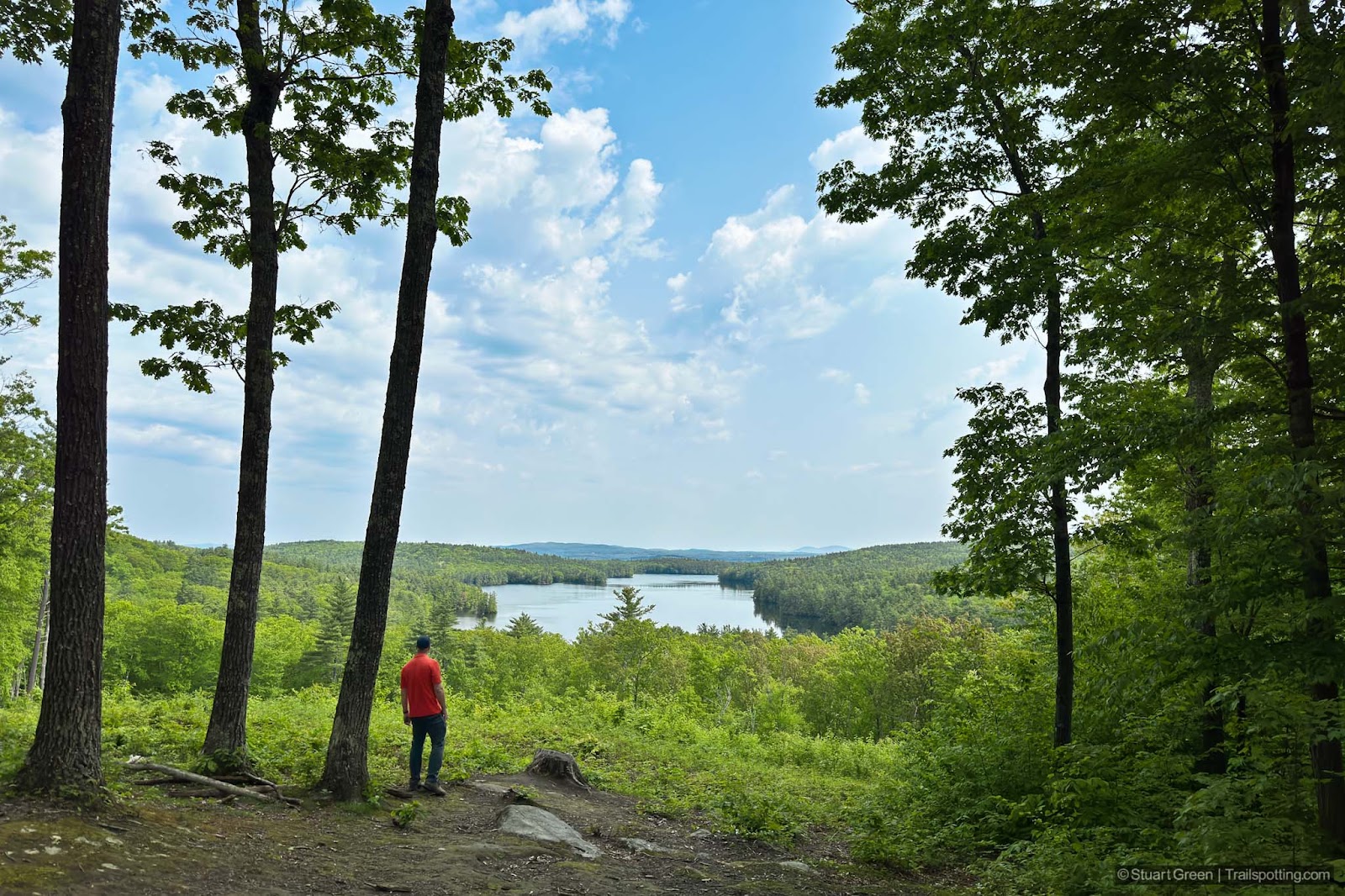
Marjory Swope Park, Concord NH
• 4-star hikes
• 1.7 to 4.9 mile options
• Easy difficulty | Gain 300 to 580 feet
• Concord, NH | Merrimack Region
…
• 1.7 to 4.9 mile options
• Easy difficulty | Gain 300 to 580 feet
• Concord, NH | Merrimack Region
…
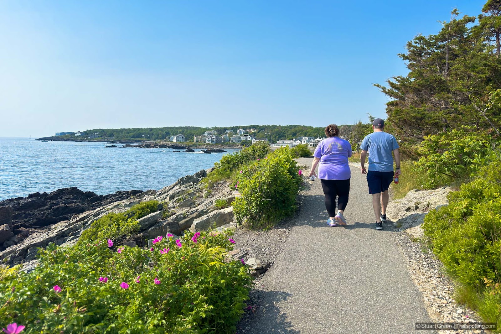
Marginal Way, Ogunquit ME
• 4-star hike
• 1.0 mile each way
• Easy difficulty | Elevation gain nominal
• Ogunquit, ME | Maine
…
• 1.0 mile each way
• Easy difficulty | Elevation gain nominal
• Ogunquit, ME | Maine
…
Cape Cod Rail Trail, MA
• 4-star trail
• 28.4 mile each way
• Easy difficulty | Easy elevation
• Yarmouth to Wellfleet, MA | Cape Cod
…
• 28.4 mile each way
• Easy difficulty | Easy elevation
• Yarmouth to Wellfleet, MA | Cape Cod
…
Old Colony Rail Trail, Cape Cod MA
• 4-star trail
• 7.5 miles each way
• Easy difficulty | Easy-moderate elevation
• Harwich to Chatham, MA | Cape Cod
…
• 7.5 miles each way
• Easy difficulty | Easy-moderate elevation
• Harwich to Chatham, MA | Cape Cod
…
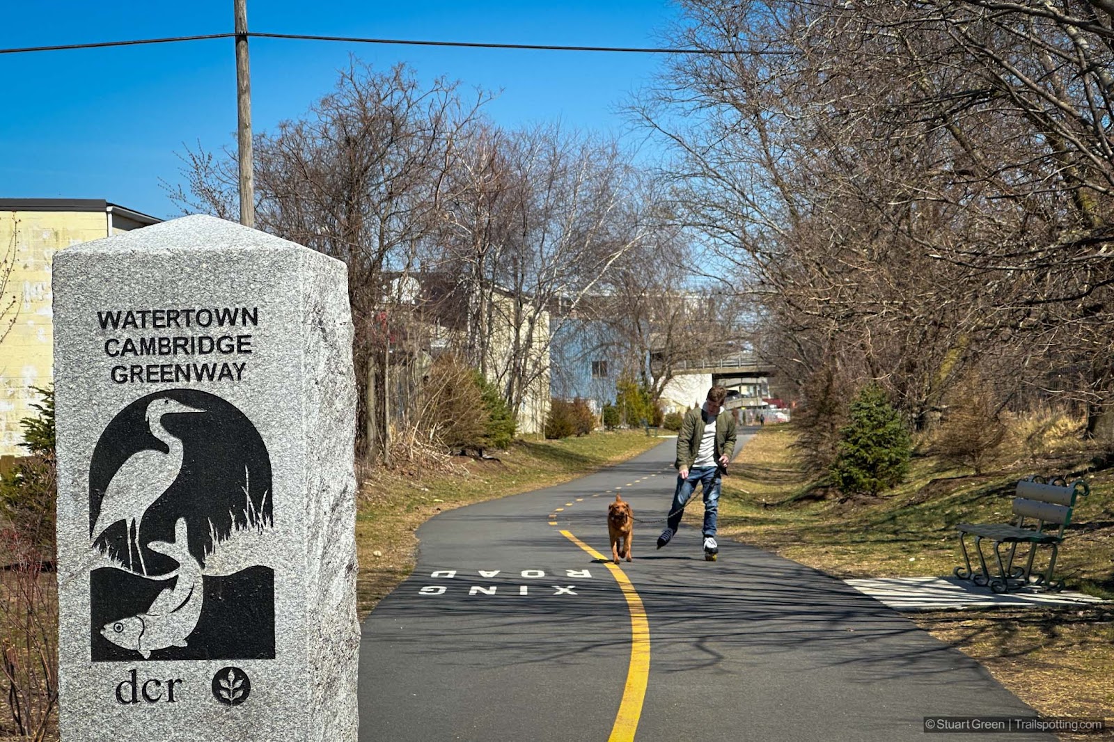
Watertown & Cambridge Rail Trails, MA
• 3-star trails
• 0.3 to 3.8 miles each way
• Easy difficulty | Easy elevation
• Watertown & Cambridge, MA | NE Massachusetts
…
• 0.3 to 3.8 miles each way
• Easy difficulty | Easy elevation
• Watertown & Cambridge, MA | NE Massachusetts
…
Northern Rail Trail, NH
• 4 & 5-star trail
• 58.0 miles each way
• Easy difficulty • Easy-moderate elevation
• Lebanon to Boscawen, NH • Sunapee Region
…
• 58.0 miles each way
• Easy difficulty • Easy-moderate elevation
• Lebanon to Boscawen, NH • Sunapee Region
…
Pack & North Pack Monadnock, NH
• 3 & 4-star hikes
• 2.7 to 7.7 mile options
• Medium difficulty | Gain 810 to 1360 ft
• Greenfield & Peterborough, NH | Monadnock Region
…
• 2.7 to 7.7 mile options
• Medium difficulty | Gain 810 to 1360 ft
• Greenfield & Peterborough, NH | Monadnock Region
…
The Nipple, Blue Lakes CA
• 4-star hike
• 6.2 mile out & back
• Medium difficulty | Gain 1,230 ft (Peak 9,342ft)
• Markleeville, CA | Lake Tahoe
…
• 6.2 mile out & back
• Medium difficulty | Gain 1,230 ft (Peak 9,342ft)
• Markleeville, CA | Lake Tahoe
…
Mt Cardigan, Grafton County NH
• 4 & 5-star hikes
• 3.0 to 5.3 mile options
• Medium difficulty | Gain 1,180 to 1,860 feet
• Orange, NH | Sunapee Region
…
• 3.0 to 5.3 mile options
• Medium difficulty | Gain 1,180 to 1,860 feet
• Orange, NH | Sunapee Region
…
Sunset Hill, Lake Sunapee NH
• 3-star hikes
• 1.8 to 3.5 mile options
• Easy & Medium difficulty | Gain 540 to 740 feet
• Newbury, NH | Sunapee Region
…
• 1.8 to 3.5 mile options
• Easy & Medium difficulty | Gain 540 to 740 feet
• Newbury, NH | Sunapee Region
…
Mt Roberts & Faraway Mountain, NH
• 3 & 4-star hikes
• 2.4 to 9.7 mile options
• Medium difficulty | Gain 420 to 1,650 feet
• Moultonborough, NH | Lakes Region
…
• 2.4 to 9.7 mile options
• Medium difficulty | Gain 420 to 1,650 feet
• Moultonborough, NH | Lakes Region
…
Goffstown & Piscataquog Rail Trails, NH
• 4-star trail
• 7.5 miles each way
• Easy difficulty | Easy elevation
• Goffstown - Manchester, NH | Merrimack Region
…
• 7.5 miles each way
• Easy difficulty | Easy elevation
• Goffstown - Manchester, NH | Merrimack Region
…
Middleton Rail Trails, MA
• 3 & 4-star trails
• 2.2 to 7.5 miles each way
• Easy/Hard difficulty | Easy elevation
• Middleton to Danvers, MA | NE Massachusetts
…
• 2.2 to 7.5 miles each way
• Easy/Hard difficulty | Easy elevation
• Middleton to Danvers, MA | NE Massachusetts
…
Newburyport Clipper City Rail Trail, MA
• 3-star trail
• 3.5 mile loop
• Easy difficulty | Easy elevation
• Newburyport, MA | NE Massachusetts
…
• 3.5 mile loop
• Easy difficulty | Easy elevation
• Newburyport, MA | NE Massachusetts
…
Boxford-Georgetown-Byfield Rail Trails, MA
• 3-star trails
• 8.3 miles each way
• Easy/Medium difficulty | Easy elevation
• Boxford-Georgetown-Byfield, MA | NE Massachusetts
…
• 8.3 miles each way
• Easy/Medium difficulty | Easy elevation
• Boxford-Georgetown-Byfield, MA | NE Massachusetts
…
Trailspotting is non-commercial, ad-free and for the public good.
Content provided without warranty of accuracy. Copyright © 2005-2024 Stuart Green all rights reserved. Reproduction requires explicit consent.
About Trailspotting .
Content provided without warranty of accuracy. Copyright © 2005-2024 Stuart Green all rights reserved. Reproduction requires explicit consent.

