
Mt Cardigan, Grafton County NH
• 5-star hikes
• 3 to 5 mile options
• Moderate & Hard | Gain 1,180 to 1,880 feet
• Orange, NH | Sunapee Region
.

Mt Cardigan viewed from Firescrew on East Loop.
Although the New Hampshire timberline is over four thousand feet above sea level, there are several notable mountain summits below this height that are bereft of trees, affording spectacular views. Mount Cardigan is one of these summits, caused by a 1855 forest fire which burned off vegetation and topsoil resulting in a denuded and desolate peak. The mountain’s loss is our gain – at least in terms of the views available to us from the summit. This article explores the best ways for day hikers to reach the summit and find the best trails and views.
We've explored the popular routes to the summit of Mount Cardigan and we can recommend all of them, but which one is best for you will depend on your preference for mileage and difficulty of terrain.
| ⬤ 4★ West Ridge Trail
GPX File · AllTrails · Directions GPX? |
| ⬤ 5★ West Loop
GPX File · AllTrails · Directions |
| ⬤ 5★ East Loop
GPX File · AllTrails · Directions |
| ⬤ 5★ Holt (Manning Loop)
GPX File · AllTrails · Directions |
| ⬤ 5★ Holt (Clark Loop)
GPX File · AllTrails · Directions |
| P Free parking |
⬤ West Ridge Trail
Shortest route. Family friendly.
This is the shortest route from trailhead to summit, and suitable for hikers of all ages. After hiking through light forest across rocks and roots, the landscape changes to exposed granite slabs and squat evergreen trees. Continue up the slabs to reach the summit. The State Park trailhead is appointed with a picnic area and restrooms, though outside of peak season the restrooms are usually out of action.
⬤ West Loop
More views. Additional Peak.
This route combines West Ridge Trail with South Ridge Trail for more views and trail variety. Begin at the state park trailhead and follow the West Ridge Trail through a forest of maple, birch and beech trees for two-thirds of a mile to the junction that marks the start of the South Ridge Trail. Choosing a counter-clockwise loop, continue through the forest on the South Ridge Trail until the tree line recedes around 1 mile into your hike. The forest trail involves some level sections, but also rocky steps and some roots with occasional mud in places. The return trip on the clockwise route proceeds down the West Ridge Trail all the way back to the trailhead and parking lot, for a total length of 3.4 miles.

Forest of maple, birch and beech on the West Loop.
⬤ East Loop
Great views. More challenging terrain.
Bridging the Clark Trail and the Manning Trail with the Mowglis Trail to Firescrew Mountain serves as an excellent moderate loop on Cardigan's eastern flanks. This route offers a variety of terrain, includes the second peak of Firescrew Mountain and has excellent views of Cardigan's summit from the North. Both trails feature some steep granite slabs and the Manning Trail includes a few rock scrambles too. The jury is out on whether a clockwise or counter-clockwise route is best. If you seek the shortest moderate eastern route, do an out-and-back of Clark for 4.8 miles and 1,730 feet of elevation gain, though you do miss out on some of the best views.
⬤ Holt Trail
Hard. Attempt only in ideal conditions.
This trail isn't for the faint of heart, but it is our personal favorite way up the mountain. Described by AMC as "one of the most difficult trails in New England" due mostly to a couple of particular patches of steep granite, experienced hikers should enjoy this route providing they tackle it in perfect conditions and with high-friction footwear. Though pitched at a steep gradient at these two locations, the terrain was rough enough to get plenty of purchase with hands and feet, and at no point was our mild fear of heights triggered.
 Holt Trail in profile. Also a Comic Sans warning warning to hikers.
We've provided links to two looping routes that return to the east trailhead, so when you ascend Holt Trail, you can choose whether to return on the Clark or Manning Trail. Clark is the shorter route, but Manning will provide you with more varied and additional mountain views. We advise against trying to hike the Holt Trail during wet or icy weather, and recommend against trying to descend using the Holt Trail.

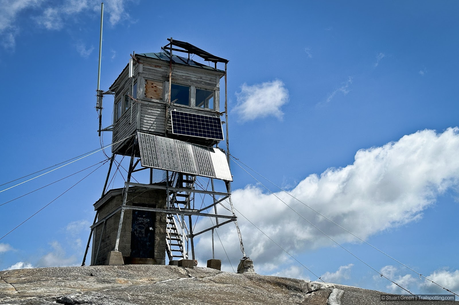
Mount Cardigan's refurbished fire tower (before).

Views on the descent of the West Ridge Trail.

Fall colors on the West trails. | East trailhead at the AMC Lodge.

Final Holt Trail section, with easterly views beyond.
Tangents:
• Official: NH State Parks
• AllTrails Public: West Loop,
• Facebook Group: Comment on this article

Trailspotting Nearby
4★ Big SugarloafMt (4 mi) ·
4★ Ragged Mt (4-7 mi) ·
5★ Northern Rail Trail (58 mi) ·
Show Map
4★ Big Sugarloaf

NH 52 With A View
Trailspotting map and routes to reach the 52 New Hampshire peaks with the best views in the state!
Trailspotting map and routes to reach the 52 New Hampshire peaks with the best views in the state!

New England Fire Towers
Discover our map of fire towers and the trails to find them.
Discover our map of fire towers and the trails to find them.