Posts
Showing posts with the label railtrails+medium
Goathland to Grosmont, North Yorkshire UK
• 4-star hikes
• 3 to 8 mile options
• Easy/Medium difficulty | Gain 310 to 1,200 feet
• North York Moors, UK | North Yorkshire
…
• 3 to 8 mile options
• Easy/Medium difficulty | Gain 310 to 1,200 feet
• North York Moors, UK | North Yorkshire
…
B&M Rail Trail, Amherst NH
• 3-star trail
• 0.9 miles each way
• Medium difficulty | Easy elevation
• Amherst, NH | Merrimack Region
…
• 0.9 miles each way
• Medium difficulty | Easy elevation
• Amherst, NH | Merrimack Region
…
Harrisville & Hancock Rail Trails NH
• 3 & 4 star trails
• 0.5 to 2.8 miles each way
• Medium difficulty | Easy elevation
• Marlborough-Harrisville-Hancock, NH | Monadnock Region
…
• 0.5 to 2.8 miles each way
• Medium difficulty | Easy elevation
• Marlborough-Harrisville-Hancock, NH | Monadnock Region
…
Upper Coos Rail Trail, NH
• 4-star trail
• 9.5 miles each way
• Medium difficulty | Easy elevation
• Colebrook NH - Beecher Falls VT | Great North Woods
…
• 9.5 miles each way
• Medium difficulty | Easy elevation
• Colebrook NH - Beecher Falls VT | Great North Woods
…
Warren Recreational Rail Trail, NH
• 4-star trail
• 4 to 15.3 miles each way
• Easy/med difficulty | Easy/med elevation
• Warren, NH | White Mountains
…
• 4 to 15.3 miles each way
• Easy/med difficulty | Easy/med elevation
• Warren, NH | White Mountains
…
Old Colony Nature Path, Provincetown MA
• 3-star trail
• 1.5 mile each way
• Easy/medium difficulty | Easy elevation
• Provincetown, MA | Cape Cod
…
• 1.5 mile each way
• Easy/medium difficulty | Easy elevation
• Provincetown, MA | Cape Cod
…
Goffstown & Piscataquog Rail Trails, NH
• 4-star trail
• 7.5 miles each way
• Easy difficulty | Easy elevation
• Goffstown - Manchester, NH | Merrimack Region
…
• 7.5 miles each way
• Easy difficulty | Easy elevation
• Goffstown - Manchester, NH | Merrimack Region
…
Boxford-Georgetown-Byfield Rail Trails, MA
• 3-star trails
• 8.3 miles each way
• Easy/Medium difficulty | Easy elevation
• Boxford-Georgetown-Byfield, MA | NE Massachusetts
…
• 8.3 miles each way
• Easy/Medium difficulty | Easy elevation
• Boxford-Georgetown-Byfield, MA | NE Massachusetts
…
Rochester & Farmington Rail Trails, NH
• 3-star trails
• 1.9 to 9.1 miles each way
• Medium difficulty | Easy elevation
• Farmington - Rochester, NH | Seacoast Region
…
• 1.9 to 9.1 miles each way
• Medium difficulty | Easy elevation
• Farmington - Rochester, NH | Seacoast Region
…
Cheshire Rail Trail South, NH
• 4-star trail
• 20.3 miles each way
• Medium difficulty | Moderate elevation
• Keene - Fitzwilliam, NH | Monadnock Region
…
• 20.3 miles each way
• Medium difficulty | Moderate elevation
• Keene - Fitzwilliam, NH | Monadnock Region
…
Seacoast Greenway Rail Trail, NH
• 4-star trail
• 11.6 miles each way
• Medium difficulty | Easy elevation
• Portsmouth - Seabrook, NH | Seacoast Region
…
• 11.6 miles each way
• Medium difficulty | Easy elevation
• Portsmouth - Seabrook, NH | Seacoast Region
…
Sugar River Rail Trail & Bobby Woodman, NH
• 5-star trail
• 9.5 to 11.3 miles each way
• Medium - Hard difficulty | Moderate elevation
• Newport - Claremont, NH | Sunapee Region
…
• 9.5 to 11.3 miles each way
• Medium - Hard difficulty | Moderate elevation
• Newport - Claremont, NH | Sunapee Region
…
Windham Greenway Rail Trail, NH
• 3-star trail
• 2.6 miles each way
• Medium difficulty | Easy elevation
• Windham NH | Merrimack Region
…
• 2.6 miles each way
• Medium difficulty | Easy elevation
• Windham NH | Merrimack Region
…
Granite-Brookline-Potanpio Rail Trails, NH
• 4-star trail
• 11.0 miles each way
• Easy/Medium difficulty | Easy - Moderate elevation
• Milford to Brookline NH | Merrimack Region
…
• 11.0 miles each way
• Easy/Medium difficulty | Easy - Moderate elevation
• Milford to Brookline NH | Merrimack Region
…
Concord-Lake Sunapee Rail Trail, NH
• 4-star trail
• 8.0 miles each way (in segments)
• Easy & Medium | Easy elevation
• Newbury - Concord, NH | Merrimack,Sunapee Region
…
• 8.0 miles each way (in segments)
• Easy & Medium | Easy elevation
• Newbury - Concord, NH | Merrimack,Sunapee Region
…
Mast Yard Rail Trail, Hopkinton NH
• 3-star trail
• 1.7 miles each way
• Medium difficulty | Easy elevation
• Hopkinton - Concord, NH | Merrimack Region
…
• 1.7 miles each way
• Medium difficulty | Easy elevation
• Hopkinton - Concord, NH | Merrimack Region
…
Fisherville Rd Rail Trail, Concord NH
• 4-star trail
• 2.5 miles each way
• Medium difficulty | Easy elevation
• Concord, NH | Merrimack Region
…
• 2.5 miles each way
• Medium difficulty | Easy elevation
• Concord, NH | Merrimack Region
…
Mason & Greenville Rail Trails, NH
• 4-star trail
• 8.6 miles each way
• Medium difficulty | Easy - Moderate elevation
• Mason - Greenville, NH | Monadnock Region
…
• 8.6 miles each way
• Medium difficulty | Easy - Moderate elevation
• Mason - Greenville, NH | Monadnock Region
…
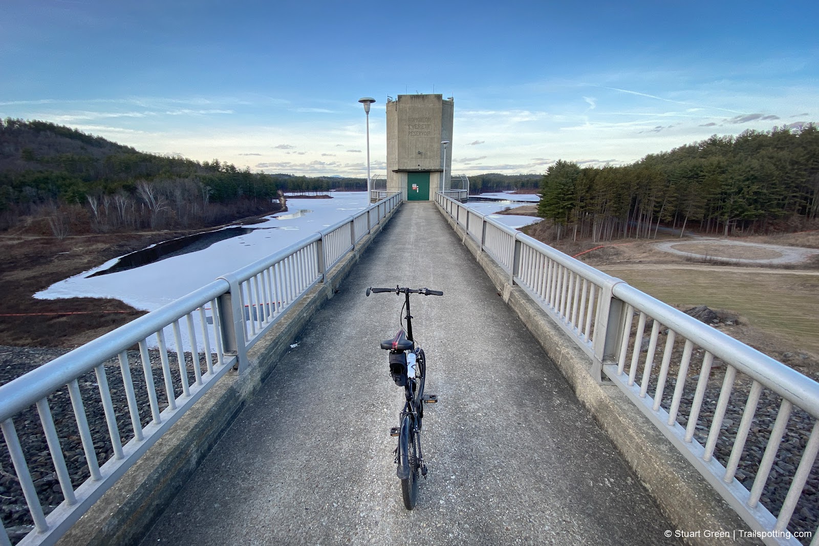
Everett Dam & Weare Rail Trails NH
• 3-star trails
• 3.5 miles each way (over 3 trails)
• Medium difficulty | Easy - Moderate elevation
• Weare - Henniker, NH | Merrimack Region
…
• 3.5 miles each way (over 3 trails)
• Medium difficulty | Easy - Moderate elevation
• Weare - Henniker, NH | Merrimack Region
…
Henniker & Hopkinton Rail Trails NH
• 3-star trails
• 6.3 miles each way (over 3 trails)
• Medium difficulty | Easy elevation
• Henniker - Hopkinton, NH | Merrimack Region
…
• 6.3 miles each way (over 3 trails)
• Medium difficulty | Easy elevation
• Henniker - Hopkinton, NH | Merrimack Region
…
Trailspotting is non-commercial, ad-free and for the public good.
Content provided without warranty of accuracy. Copyright © 2005-2024 Stuart Green all rights reserved. Reproduction requires explicit consent.
About Trailspotting .
Content provided without warranty of accuracy. Copyright © 2005-2024 Stuart Green all rights reserved. Reproduction requires explicit consent.


