Flamborough Head, East Yorkshire UK
• 4-star hikes
• 1 to 4 mile options
• Easy & Moderate | Gain 100 to 300 feet
• Flamborough, UK | United Kingdom
.

Derelict boat at Flamborough's North Landing
Flamborough Head is a striking natural outcropping, jutting out of the rugged Yorkshire coastline and into the North Sea. Though the hard chalk cliffs offer resistance to the constant battering of the sea, they still succumb to erosion that that reveals dramatic caves, arches and freestanding vertical rocky stacks.
A cliffside walk along our suggested windswept headland trail leads between the towering 'new' 1806 Flamborough Head Lighthouse and an old lifeboat launch at North Landing. Along with the panoramic seafront views, take time to inspect the abandoned World War II concrete defences on the way. Alternatively, descend down the lifeboat slipway to the beach of North Landing and investigate rockpools and sea caves, including the cavernous Robin Lythe's Hole.
| ⬤
4★ Cliff Trail
GPX File · AllTrails · DirectionsGPX? |
| ⬤
4★ Caves Trail
GPX File · AllTrails · Directions |
| £ Paid parking |
Also accompanying you on any walks around these coastal headlands are the many, many sea birds that make Flamborough Head one of the best birdwatching locations anywhere in Britain. The north side of this outcropping of cliffs hold the largest colony of breeding seabirds on mainland Britain, as is plainly obvious from all who have visited and witnessed the cacophony of shrieking birdcalls that constantly echoes off the cliff walls.
⬤ Cliff Trail
The 1.75 mile trail from Flamborough Head Lighthouse to North Landing is mostly single track and well-worn as it winds its way around the clifftops. Offering great views of the sea birds swooping between the cliffs below, the route still manages to mostly keep you away from the cliff edges. Concrete costal defences from the Second World War can be found all over Flamborough Head, including a couple visible on this trail's route. Also, consider continuing a little further past the lighthouse for a dramatic photo opportunity of the Flamborough Sea Arch, which we've marked on the map.

Chalk cliffs of Flamborough Head | Photo: Tall-Guy
⬤ Caves Trail
North Landing was abandoned as a RNLI lifeboat station in 1938 and now the building atop the slipway offers burgers, drinks and ice cream for the benefit of the visitors to this small sheltered sandy beach. When the tide has receded it's possible to carefully step across the slippery rocks to explore the caves carved out of the rocks by the sea.
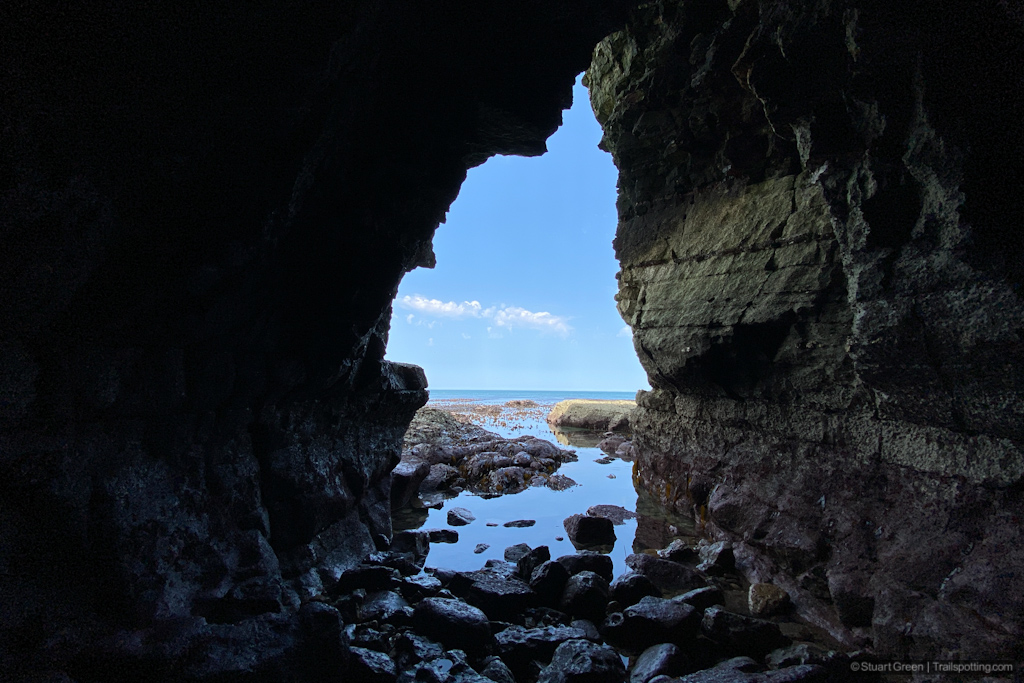
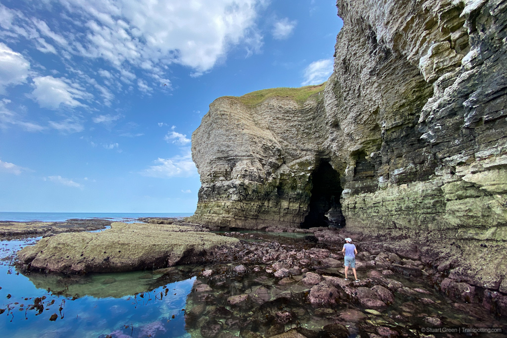
The cave known as Robin Lythe's Hole is by far the largest of these caves, and though its naming is lost to history, locals and visitors alike tell fanciful stories involving shipwrecks and smugglers. Enter by way of an open slot in the South Cliff and proceed down a short corridoor where you should expect to get your feet wet, even at low tide. From here the cave opens into a spacious cavern that leads to a second entrance facing the sea. Make up your own tall tales about what this sea cave was used for, as you head outside to admire the Flamborough Head cliffs from sea level by this second cave entrance.

Inside Robin Lythe's Hole at low tide.
Be sure to check the weather before visiting Flamborough Head, because even in the sunniest weather this coastal prominance can be socked in with fog. Also if you want to explore Robin Lythe's cave be sure to do so at low tide and take care around slippery rocks.
We'll leave you with one final but surprising fact for our American audiences; Flamborough Head is actually an American Revolutionary War battleground. More precicely was the site of a 1779 naval battle that in addition to the death of 290 people also resulted in the sinking of one ship and the capture of two others .

Mind your step in this cavernous but slippery space.

Journeying through the cave leads to dramatic cliff views.
Tangents:
• Facebook Group: Comment, Follow Us


UK Hiking Trails
A growing map of trail reviews and maps, particularly in the North of England.
A growing map of trail reviews and maps, particularly in the North of England.
