
Eaton Canyon Falls, Pasadena CA
• 4-star hike
• 3 to 4 mile options
• Easy & Moderate | Gain 420 to 790 feet
• Pasadena, CA | Los Angeles Region
.
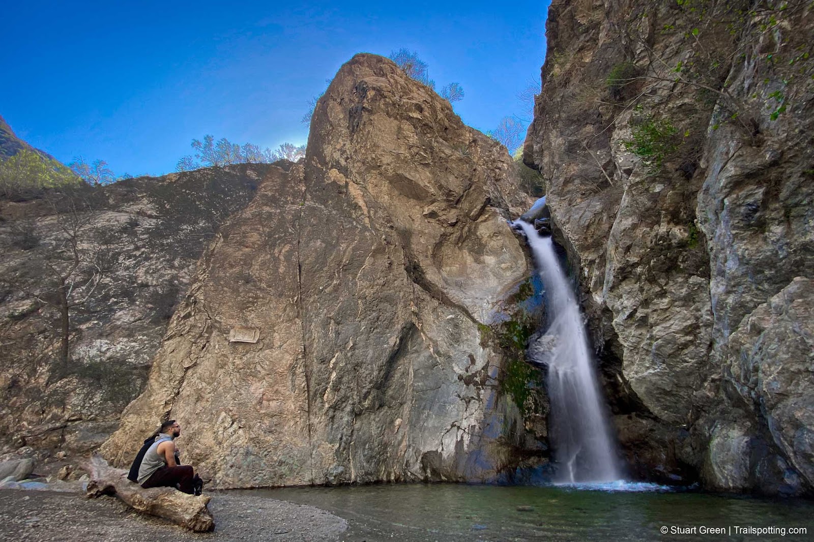
Enjoying the cooling waterfall spray at canyon's end.
Much to some people's surprise Southern California can boast of having several great waterfalls on their doorstep, and the waterfall at the end of the Eaton Canyon Falls trail is no exception.
Highlights on this trail include the scramble along river rocks inside the winding and shady canyon, and the waterfall that plunges forty feet into a crystal clear pool. Enjoy the shade and the views, or take a wade into the waters to cool off on a hot day.
The trail begins at a visitor center and large free parking lot. Due to the trail's popularity expect parking to fill quickly, particularly weekends and holidays.
| ⬤ 4★ Eaton Canyon Falls
GPX File · AllTrails · Directions GPX? |
| ⬤ 4★ Falls Trail & Wilson Loop
GPX File · AllTrails · Directions |
| P Free parking
|
⬤ Eaton Canyon Falls
The trail to the waterfall begins as a long, flat dusty trail with greenery all around. As you admire the San Gabriel Mountains that rise in front of you, you'll hardly notice the modest elevation gain. Around two-thirds of the distance you'll bear left and continue under a canyon-spanning concrete bridge and into Eaton Canyon itself. For the remaining half-mile the ground underfoot is mostly rocky with several creek crossings, but the difficulty is still pretty easy scrambling. Trail definition goes awry at times so just pick your own preferred route - you can't get lost in this narrowing gorge.
⬤ Falls Trail & Wilson Loop
This route combines the canyon trail with a hillside walk up the dirt Mount Wilson Toll Road, and provides some spectacular views over the Los Angeles Basin. Be prepared for lots of sunshine - there's no shade on this mountain detour.
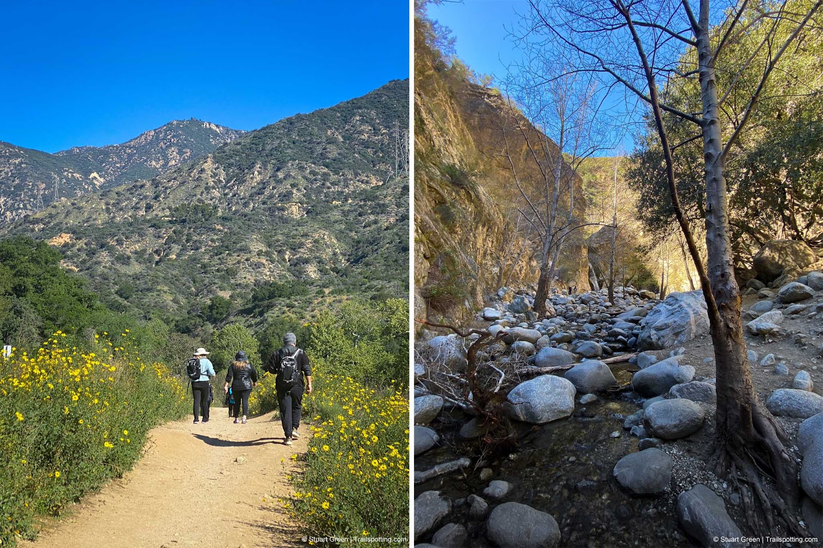
A tale of two trails. Flat & easy until you enter the canyon.
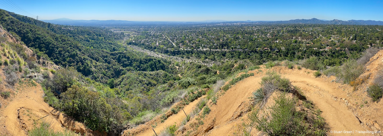
Switchbacks on the descent from the Mt Wilson Road detour.
Tangents:
• Official: LA County Parks
• AllTrails Public: Eaton Canyon Tr
• Facebook Group: Comment, Follow Us

LA's Best Trails
Explore the natural side of Los Angeles with Trailspotting's Best Trails feature.
Explore the natural side of Los Angeles with Trailspotting's Best Trails feature.

California Waterfalls
Trails to some of California's greatest waterfalls.
Trails to some of California's greatest waterfalls.

Best Trails of California
See our favorite hiking trails for each region of California.
See our favorite hiking trails for each region of California.