
Montara Mountain, Pacifica CA
• 4-star hike
• 7 to 11 mile options
• Moderate | Gain 1,650 to 2,180 feet
• Pacifica, CA | San Francisco Region
.
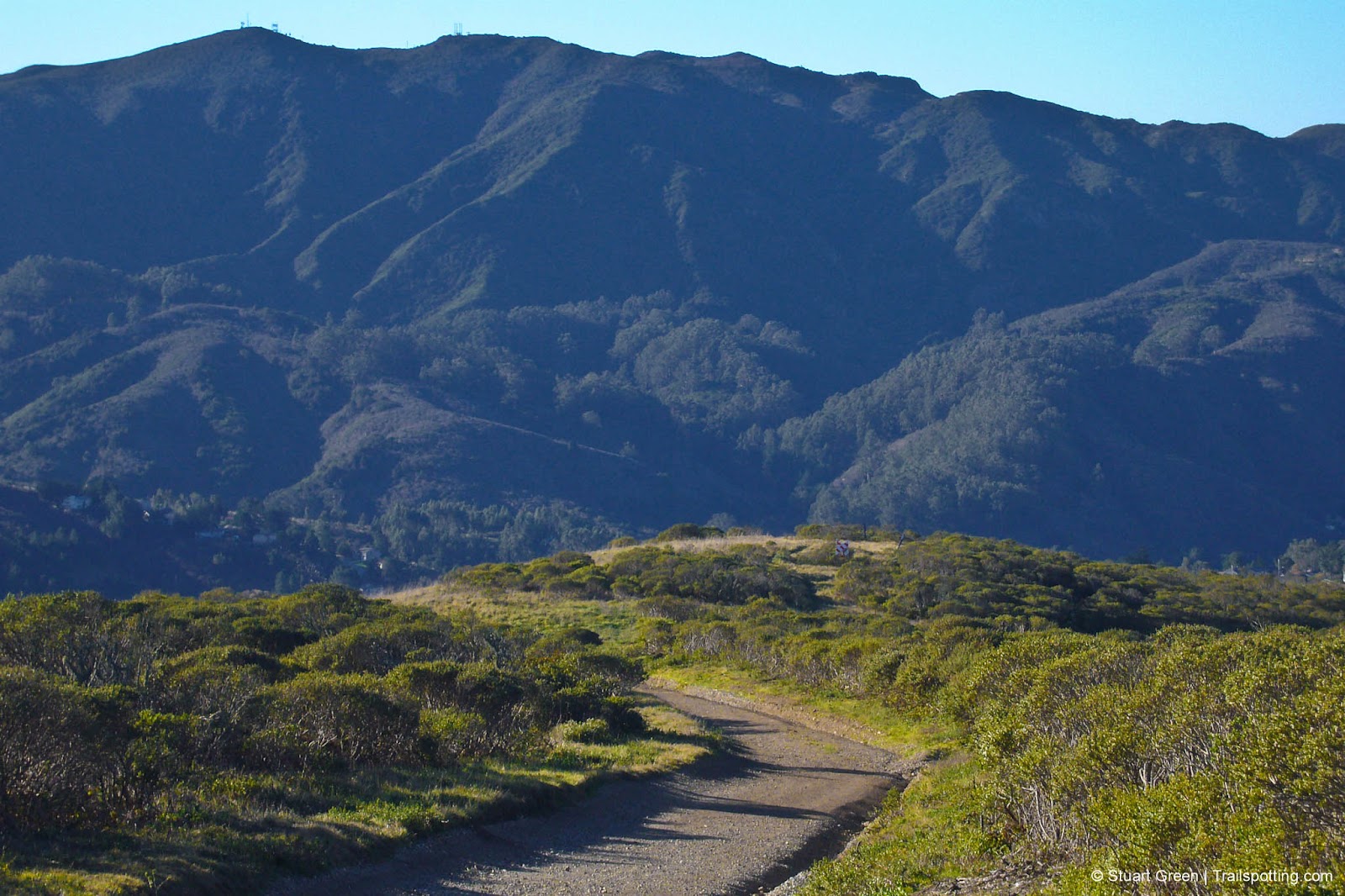
The massiveness of Montara Mountain, from Sweeney Ridge.
If you’re looking for sun along the fog-bound San Francisco peninsula coastline, then Montara Mountain is the place to head for. Rising almost 2,000 feet above the beaches of Pacifica, here is where the sun often breaks through the clouds. Even when the sun continues to hide, there’s still a chance that by the time you hike to the summit you’ll be hiking above the clouds.
You're spoiled for choice if you want to scale this peak, so we've traced the best and most popular routes to the top and provided individual maps that you can use to navigate the area's trails.
| ⬤ 4★ San Pedro Valley Park
GPX File · AllTrails · Directions** GPX? |
| ⬤ 4★ North Peak Access
GPX File · AllTrails · Directions* |
| ⬤ 4★ Grey Whale Cove
GPX File · AllTrails · Directions* |
| ⬤ 4★ Pedro Mountain Road
GPX File · AllTrails · Directions* |
| P *Free parking
|
⬤ San Pedro Valley Park
Our favorite way up the mountain is also the most direct. Beginning at San Pedro Valley Park the narrow trail winds through eucalyptus forest then rocky coastal chapparal before linking half way up the North Peak Access Road. This approach up the northern flanks of the mountain offers some great coastal views of Pacifica and across the Golden Gate. We have more about San Pedro Valley Park in a separate trail review linked in the 'Trailspotting Nearby' section at the foot of the page.
⬤ North Peak Access
Wide and steady, this winding service road provides a gradual climb up Montara Mountain with views of the approaching peak.

Montara Mountain Trail in San Pedro Valley Park.
⬤ Grey Whale Cove
An alternative way of staring a North Peak Access Road hike, but with an extended preamble up and along some coastal hills. From the Grey Whale Cove trailhead some like to make their own route directly up the hill and shortcut the winding trail, but please be respectful of the landscape.
⬤ Pedro Mountain Road
Before the Devils' Slide road in front of the coastal cliffs, and definitely before the digging of the Tom Lantos Tunnel, the Pedro Mountain Road was the only connection between Pacifica and Half Moon Bay, and the smaller settlements in between. Crumbling pavement still exists on this wide trail, before it connects up to the North Peak Access Road.
Tangents:
• Official: Montara State Beach
• AllTrails Public: North Peak
• Facebook Group: Comment, Follow Us

Trailspotting Nearby
4★ San Pedro Valley Park (2-5 mi) ·
4★ Sweeney Ridge (3-4 mi) ·
4★ Mori Point (1-2 mi) ·
Show Map
San Francisco Bay's Best Trails
For great hiking trails throughout the Bay Area check these out.
For great hiking trails throughout the Bay Area check these out.

California Summits
Explore mountain-top hikes around California with Trailspotting.
Explore mountain-top hikes around California with Trailspotting.


