
Sweeney Ridge & Portola Discovery CA
• 4-star hike
• 2 to 4 mile options
• Easy & Moderate | Gain 560 to 920 feet
• Pacifica, CA | San Francisco Region
.
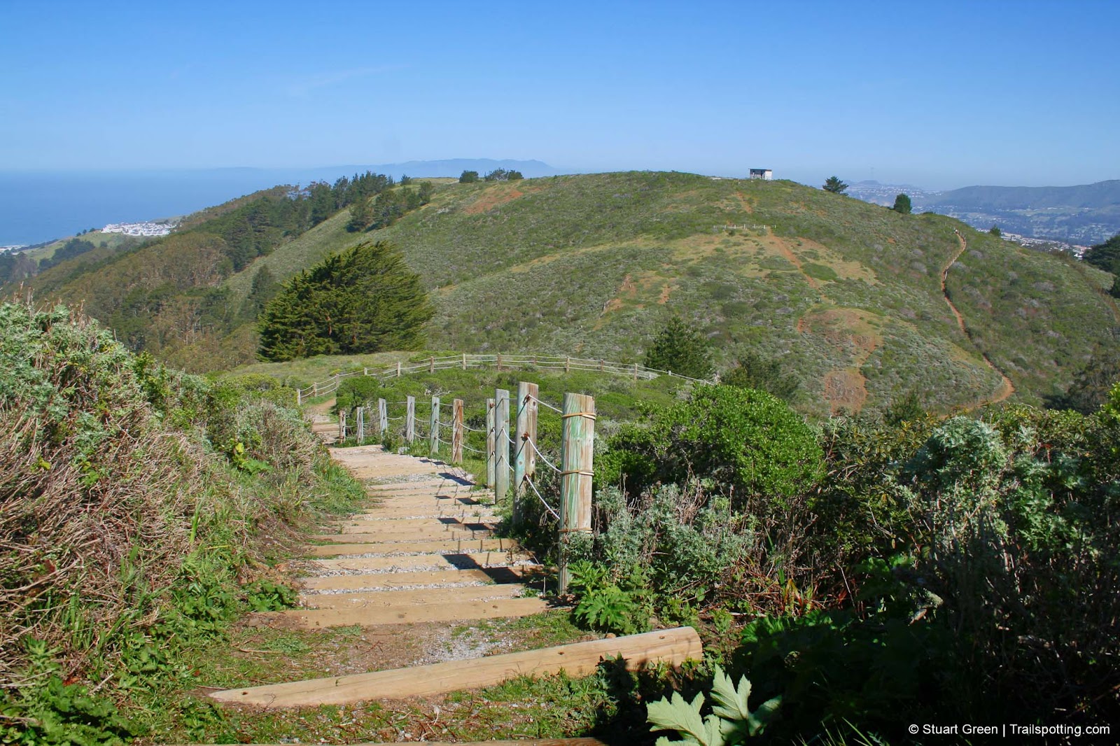
The Notch, on the Skyline College trail.
Twelve hundred feet above the Pacific Ocean, the Sweeney Ridge trail traverses the most northerly part of the Santa Cruz coastal range. Up here you can explore the former site of the 1950s Nike missile base, or step further back in time and visit the spot where Gaspar de Portola first discovered the San Francisco bay for the European explorers in 1769.
There are several different approaches to Sweeney Ridge and we've identified the best ones for you to choose between. We recommend these trails during all seasons. You might like to check out the weather before setting off because cloud and coastal fog can obscure the views on occasions, though even hiking through fog up here can still be quite appealing.
| ⬤ 4★ Mori Ridge to Nike Base
GPX File · AllTrails · Directions GPX? |
| ⬤ 3★ Sneath Lane to Discovery Site
GPX File · AllTrails · Directions |
| ⬤ 4★ Skyline College to Discovery Site
GPX File · AllTrails · Directions |
| ⬤ 3★ Baquiano Trail to Discovery Site
GPX File · AllTrails · Directions |
| P Free parking |
⬤ Mori Ridge to Nike Base
Our favorite route up to Sweeney Ridge starts next to the Shelldance Nursery parking lot. Approach on Route 1 from the South, and take a sharp turn up the hill at the 'Orchids' sign. This trail provides excellent views towards San Francisco before reaching the site of the former Nike missile base. The return journey is even more picturesque as you look out over the Pacific Ocean. There's one particularly steep stretch of trail, that you might have to tread carefully. Add 0.5 miles each way if you want to check out the discover site at the opposite end of the ridgeline.
⬤ Sneath Lane to Discovery Site
This wide paved road offers a gentle incline up the mountain. Views over the peninsula towards the picturesque bay. If you'd like to bring your bicycles up to the ridgeline, then this is the way to do it.
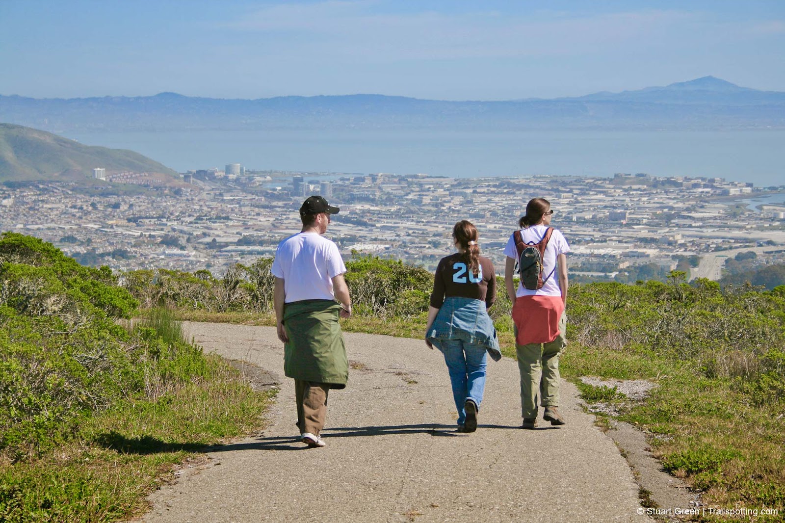
Sneath Lane trail, with a distant Mt Diablo across the Bay.
⬤ Skyline College to Discovery Site
Our second favorite way to Sweeney Ridge begins at the college parking lot. Starts with some great views towards the Pacific Ocean, then the peninsula, before tackling a notch in the hillside with a set of steps on each side.
⬤ Baquiano Trail to Discovery Site
One of the less frequented trails on Sweeney Ridge is also the shortest as it starts half-way up the mountain at the end of Fassler Avenue in the Linda Mar region of Pacifica. Start out with the hardest part - around 300 feet of switchbacks, then follow the sloping ridge to the top.
From the Portola Discovery Site, Sweeney Ridge continues South for a further 1.2 miles before reaching a locked gate indicating the restricted access above the San Andreas Lake, which is used as a reservoir for public drinking water.
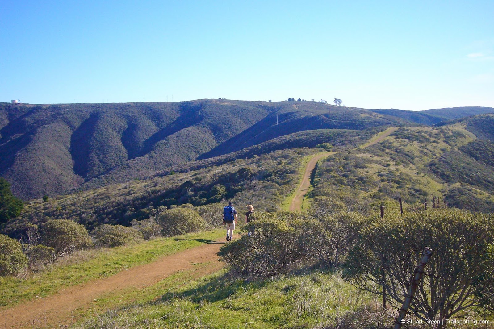
On the Baquiano Trail, leading up to Sweeney Ridge.
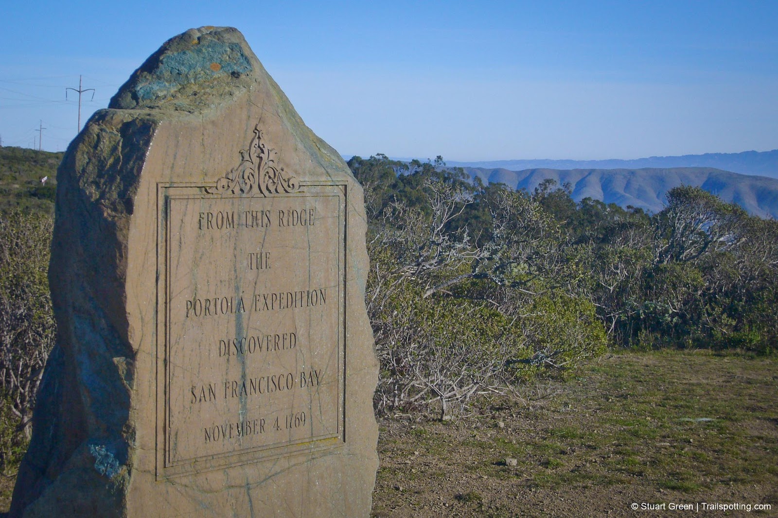
The Portola Discovery Site, on Sweeney Ridge.
Tangents:
• Official: Sweeney Ridge,
• AllTrails Public: Sweeney Ridge
• Facebook Group: Comment, Follow Us

Trailspotting Nearby
4★ Mori Point (1-2 mi) ·
4★ San Bruno Mountain (3-7 mi) ·
3★ Devil's Slide (3 mi) ·
Show Map

San Francisco Best Trails
For great hiking trails throughout the region, check these out.
For great hiking trails throughout the region, check these out.

Yosemite's Best Trails
Epic scenery and adventures await. Summit hikes, waterfalls and more to choose from.
Epic scenery and adventures await. Summit hikes, waterfalls and more to choose from.