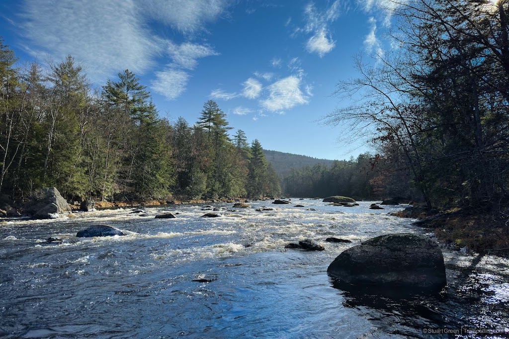
Brown's Way Rail Trail, Hillsboro NH
• 3-star trail
• 4 miles each way
• Moderate | Low gradient
• Hillsborough - Henniker, NH | Monadnock Region
.

The trail provides some scenic Contoocook river views.
Situated between Hillsboro and Henniker, Brown's Way is a former railroad route that closely follows the banks of the North Branch Contoocook River. The best part of the trail is the northernmost 2.3 mile section of flat but winding dirt road that offers a mostly quiet and often scenic riverside woodland route. Riding north you'll know when you reach the end of the railbed tour as Browns's Way takes an uphill route away from the river. From here the old rail alignment continues on inaccessible private property and you can't ride on it again unless you travel into Henniker.
We've mapped a further section of rail trail to the South, linking Contoocook Falls with Hillsboro on a straight and unnamed trail that appears to be signed for ATV use. Riding a bike along this segment remained rather easy, though rough enough that we wouldn't tackle this on less than a hybrid bicycle. There's not much to see on this section, but as it's our aim to find as much rideable former railroad as possible we've been sure to mark it on our map.
|
⬤⬤
3★ Brown's Way
GPX File · AllTrails · Directions GPX? |
| P Free parking |
Parking is best at the two informal locations marked on our map near Contoocook Falls as we couldn't find any spots closes to the extremes of this trail. Neither of these locations are marked parking spots, so park at your own risk and please do not obstruct roadways or residential properties.
Just half a mile south of the end of this trail is the derelict Hillsboro railroad station, located on our map behind a Family Dollar store. We also found further railroad evidence a little further along the former route on River Street, where a former rail maintenance car sits proudly, lofted into the air on a small wooden trestle. At Hillsboro the railroad would continue across the river on a now long-gone covered bridge, but we can ride the route again where West Mill Street meets Long Woods Road. See the Hillsboro Rail Trail link below for more information.
⚠ Trail Conditions: 2.3 miles of compacted gravel dirt road suitable for most bikes. Southern 1 mile segment is rougher, suited for hybrid and mountain bikes. Mostly flat throughout.

Typical conditions along the 2.3 mile northern section.

Former rail car displayed close to Hillsboro tracks at this location.
Tangents:
• Facebook Group: Comment on this article

Trailspotting Nearby
4★ Hillsborough Rail Trail (7 mi) ·
4★ Henniker & Hopkinton Rail Trails (6 mi) ·
Show Map

Rail Trails of New England
The first and only complete rail trail map. With photos, reviews and downloads.
The first and only complete rail trail map. With photos, reviews and downloads.

Best Trails NH: Monadnock Region
Check out the best hikes and rail trails around the region.
Check out the best hikes and rail trails around the region.


