
Echo Mountain, Pasadena CA
• 5-star hike
• 5 mile out-and-back
• Moderate | Gain 1,400 feet
• Pasadena CA | Los Angeles Region
.
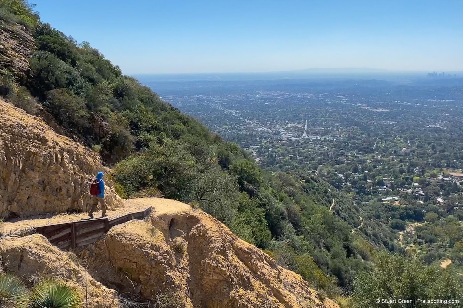
Hiking the Sam Merrill Trail high above Pasadena.
A century ago the marvels of modern industrialism meant reaching the top of Echo Mountain wouldn't demand any shoe leather, thanks to the wonders of an incline railway carrying visitors 2,200 vertical feet to the summit. At the top riders would be greeted by the sight of a hotel, dance hall, casino, observatory and another electric railway that would whisk travelers further towards the summit of Mount Lowe.
Today the only way to reach Echo Mountain summit is under human power, since the railway was closed in 1938 after forty years of service. Gone also are the buildings of what was known as "The White City in the Sky", yet rusted relics and other evidence of the mountaintop resort's heyday still remain to be discovered by hikers that make it to the summit.
| ⬤ 5★ Sam Merrill Trail
GPX File · AllTrails · Directions GPX? |
| P Free street parking |
Even without the curiosities of the mountain's historic development, hiking the Sam Merrill Trail up to Echo Mountain is a breathtaking experience. The narrow trail carved in the mountain features many switchbacks and some inventive retaining structures to keep the route in check. Mountain goat skills aren't required however, and we always felt safe - even when running back down the mountain and passing upward hikers.
We've rated this trail as medium, though be aware that there is constant elevation gain all the way to the summit. Some folk may be happy just admiring the views over Los Angeles which get even better the further you ascend.
Street parking is available near the trailhead at Cobb Estate - a place once owned by the Marx Brothers, though now turned over to the National Forest Service.
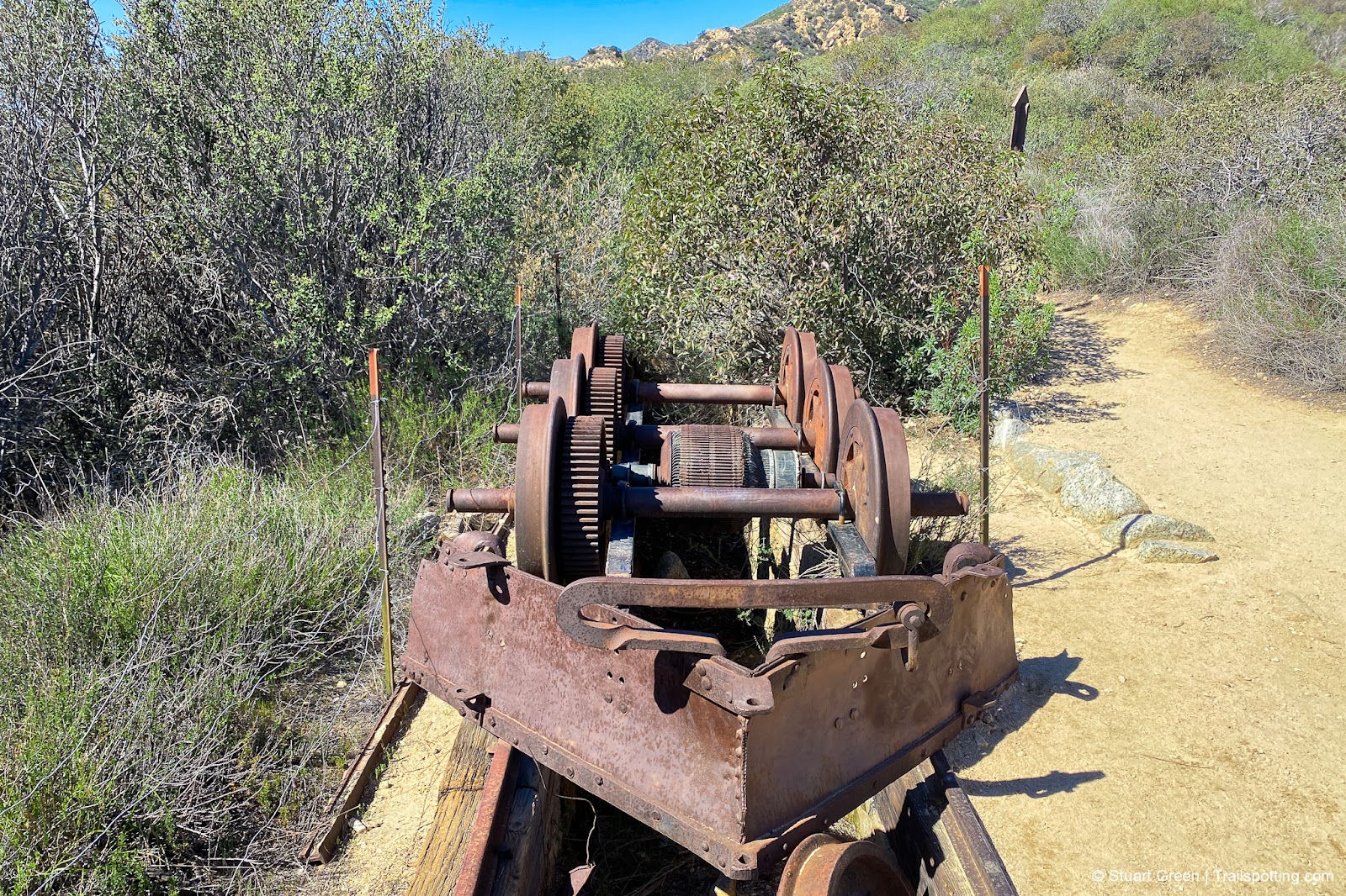
Remains of the electric trolleys that would run between mountains.
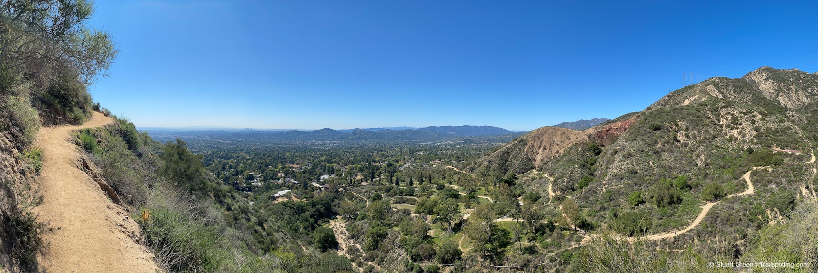
Switchback trails snaking around the mountain beneath.
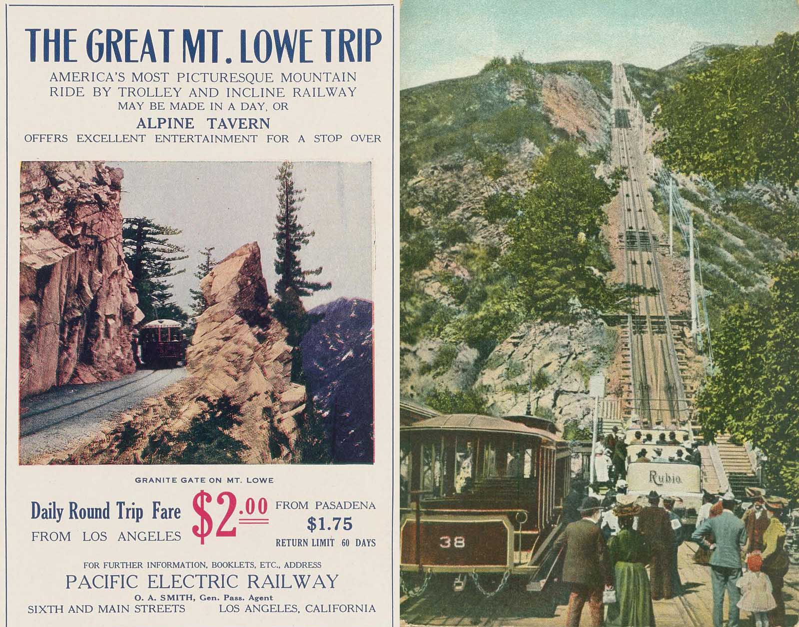
Public domain images from an earlier time on the mountain.
Tangents:
• Mount Lowe Railway: Wikipedia, YouTube
• AllTrails Public: Echo Mt Via Sam Merrill Trail
• Facebook Group: Comment, Follow Us

LA's Best Trails
Explore the natural side of Los Angeles with Trailspotting's Best Trails feature.
Explore the natural side of Los Angeles with Trailspotting's Best Trails feature.

California Summits
Explore mountain-top hikes around California with Trailspotting.
Explore mountain-top hikes around California with Trailspotting.

Best Trails of California
See our favorite hiking trails for each region of California.
See our favorite hiking trails for each region of California.