Oak Hill, Knowlton Forest, Concord NH
• 3 & 4-star hikes
• 3 to 5 mile options
• Easy | Gain 520 to 760 feet
• Concord, NH | Merrimack Region
.
 Oak Hill Fire Tower, with northerly stick season views.
Popular with Concord residents, the woodland trails of Oak Hill City Forest and Knowlton Forest parks are moderately easy to hike, with few rocky sections and low gradient paths. Trails criss-cross the forest, so we've marked out some recommended routes, all of which include a journey to the top of the recently restored fire tower. Until you reach the summit of Oak Hill where the tower is located, your views are mostly limited to the canopy of oak trees for which the park is named, though there are a couple of good viewpoints worth checking out on the route.
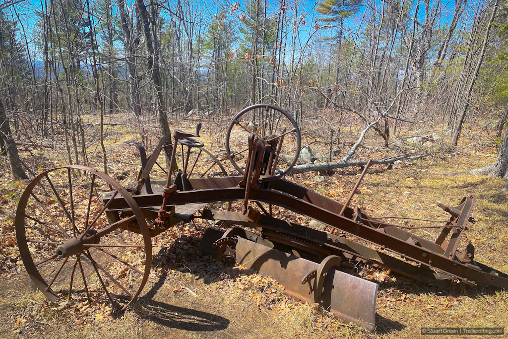
Hiking to the summit of Oak Hill is worth the ascent. Be sure to climb the stairs to the underside of the locked fire tower hut for the best panoramic views. The fire tower shares the summit with a picnic table, an ancient rusted grading machine and three ugly, but no doubt necessary microwave and radio towers. We worked hard to keep them cropped them out of our photos, of course.
| ⬤ 4★ Knowlton Loop
GPX File · AllTrails · Directions GPX? |
| ⬤ 4★ Oak Hill Loop
GPX File · AllTrails · Directions |
| ⬤ 3★ Oak Hill Tower Trail
GPX File · AllTrails · Directions |
| P Free parking |
⬤ Knowlton Loop
The Knowlton Loop offers the shortest loop trail from trailhead to tower. If time or distance is against you, you could reduce your trek further if you took a strict out-and-back route to the tower. This would total 2.9 miles and 520 feet of elevation gain, though you would be missing the viewpoint by Swope Loop.
⬤ Oak Hill Loop
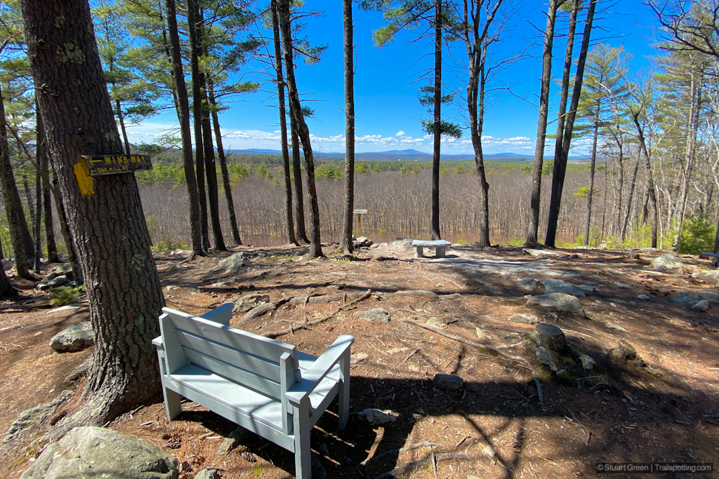
This circuitous route intersects with itself twice and offers the chance to explore most of the park. This includes two noteable viewpoints as well as the tower on top of Oak Hill. These viewpoints provide great northerly views as far as Mt. Kearsarge and Ragged Mountain on a clear day, which is particularly impressive when still so close to the city of Concord.

The best views are at the Oak Hill Vista on Vista Way.
⬤ Oak Hill Tower Trail
The Oak Hill Tower Trail is the shortest route from the Oak Hill Park Trailhead to the fire tower on the summit. We'd rate this as a 3-star trail because it doesn't include either of the great viewpoints, and only includes some partial views from the top of the tower.

Previous visitors unfamiliar with 'leave no trace' motto.
Tangents:
• Official: PDF map
• AllTrails Public: Oak Hill Tower Trail
• Facebook Group: Comment, Follow Us


New England Fire Towers
Discover our map of fire towers and the trails to find them.
Discover our map of fire towers and the trails to find them.

New England Covered Bridges
Maps, lists, directions and nearby trails to New England's covered bridges.
Maps, lists, directions and nearby trails to New England's covered bridges.


