
Bruce Freeman Rail Trail, MA
• 4-star trail
• 15 miles each way
• Easy | Low gradient
• Chelmsford to Framingham, MA |
.
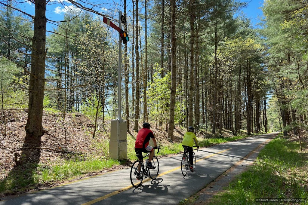
Cyclists wheeling past a restored railroad signal.
Twenty miles west of Boston, the Bruce Freeman Rail Trail winds its way on a north-south route through the quiet leafy environs of Middlesex County towns. Covering the full length of Chelmsford, Acton and Concord since only 2023 this non-motorized trail offers 15 miles of continuous asphalt pavement and includes multiple parking lots, restrooms and a couple of large trail bridges along its route.
Presently the southern end of the trail terminates at the Concord-Sudbury border, but Phase 2D of the Bruce Freeman Rail Trail is currently under way and when this extension opens (expected June 2025) it will lengthen the route by a further 4.4 miles. Ultimately the trail will be around 24 miles in length and end at Framingham.
| ⬤ 4★ Bruce Freeman Rail Trail
GPX File · AllTrails · Directions GPX? |
| P Free parking |
This exceptionally smooth asphalt trail is particularly popular with recreational trail users both locally and regionally, and due to its north-south direction doesn't see many speedy commuter bicycles along its route.
Picturesque in nature, the trail offers a variety of tree-lined views throughout and regular kinks in the former railroad alignment allow fresh scenery to reveal itself as you progress. The trail runs adjacent to several water features including Beaver Brook, Heart Pond, Nara Park and Ice House Pond, and two of these even feature beaches that we've flagged on our map.

Crossing the Assabet River.
Intersections with major roads are remarkably few, thanks to substantial trail bridges over Great Road and State Route 2. There's a signalized road crossing near West Concord station, and at the very north of the trail there are two further road crossings in Chelmsford - one of which is confusing and would benefit from additional trail signs.
By West Concord railroad station the Bruce Freeman Rail Trail passes close to the end another rail trail - the Reformatory Branch Trail - that further connects to the Minute Man Bikeway heading towards Boston. Reaching this trail requires 2.6 miles of road biking heading east along the wide State Route 62. Maps and trail reviews of other nearby trails are included in the links below.
⚠ Trail Conditions: Smooth asphalt and no significant gradient. Few road intersections. Busy on weekends and holidays.

Wooden carved statue on the trail in Chelmsford.

Catching a breath at Heart Pond.
Tangents:
• External Link: Friends of the BFRT
• AllTrail Public: Bruce Freeman Rail Trail
• TrailLink: Bruce Freeman Rail Trail
• Facebook Group: Comment, Follow Us

Trailspotting Nearby
4★ Reformatory Branch Rail Trail (4 mi) ·
4★ Minute Man Bikeway (10 mi) ·
Show Map

Rail Trails of New England
The first and only complete rail trail map. With photos, reviews and downloads.
The first and only complete rail trail map. With photos, reviews and downloads.

New England Covered Bridges
Maps, lists, directions and nearby trails to New England's covered bridges.
Maps, lists, directions and nearby trails to New England's covered bridges.