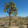
Kelso Dunes, Mojave Desert CA
• 5-star hikes
• 3 mile out-and-back
• Moderate | Gain 500 feet
• Baker, CA | Southwest Region
.

Hiking the high point is easier than it might look.
The Kelso Dunes tower impressively in the eastern Mojave Desert, forming the second-tallest dune system in California. Though the views from the parking lot are impressive, the rewards of hiking 1.5 miles to the high point of the dunes are much, much greater. This relatively short but memorable hike provides access to panoramic desert vistas and a unique natural phenomenon that many visitors overlook.
Upon first glance from the trailhead, the destination and highest point of the dunes looks more imposing and further away than it actually is. The tallest dune rises approximately 650 feet above the surrounding desert floor, creating an optical illusion regarding both distance and scale. Most hikers complete the round trip in just a couple of hours, depending on pace and time spent at the summit admiring the panoramic views.
| ⬤
5★ Kelso Dunes Trail
GPX File · AllTrails · Directions GPX? |
| P Free parking |
The trail begins on a well-defined path across flat desert terrain before reaching the base of the dunes. From this point, hikers begin the steady climb up the shifting sand surface. Though not quite as easy as hiking 500 feet of elevation on solid ground, we found the sand to be relatively firm, especially in the morning hours before the day's heat softens the surface.
About halfway up the climb, many hikers encounter a common challenge - shoes filling with sand. When our shoes started filling with sand we took them off, to find that hiking the dunes was much easier barefoot. The cool, compacted sand provides surprisingly comfortable footing, though carrying footwear is recommended for the desert floor sections at the beginning and end of the hike where vegetation could cause minor foot injury.
The trail route is unmarked, though most will find it easier to follow the route most frequently traveled. Approaching the summit, watch out for where the trail veers to the right, then follow the crest of the dune to the peak. This final section follows a narrowing ridge with dramatic dropoffs on either side, adding to the sense of elevation and accomplishment.

After 0.2 miles of light vegetation we recommend hiking barefoot.
From the summit, visitors are rewarded with sweeping views of the surrounding Mojave National Preserve, including the Providence Mountains to the east and the Devils Playground to the north. Early morning or late afternoon visits provide the most dramatic lighting for photography and more moderate temperatures for hiking.
The trailhead and parking area for Kelso Dunes Trail is located at the end of a poorly-maintained 3 mile road that can be traversed by almost any vehicle with a little care and patience. There is no fee or permit required for parking, or to enter the Mojave National Preserve.
⚠ Heat Safety Tips: Shade is extremely limited on this trail. Please stay safe in hot weather by knowing the forecast and planning to avoid the hottest parts of the day. Recognize danger signs and turn back when necessary. Wear lightweight non-cotton clothing and head coverings. Use sunblock and UV lip balm. Bring more water than you think you need, coupled with salt and electrolyte tablets for longer hikes.

Don't turn around half way! You're closer than you think.

Hiking back downhill is easier than you might imagine.
Tangents:
• National Park Service: Kelso Dunes
• AllTrails Public: Kelso Dunes
• Facebook Group: Comment, Follow Us


Best Trails of California
See our favorite hiking trails for each region of California.
See our favorite hiking trails for each region of California.

Joshua Tree's Best Trails
The hikes around Joshua Tree National Park reviewed and categorized.
The hikes around Joshua Tree National Park reviewed and categorized.
