
Henry Cowell Redwoods State Park, CA
• 5-star hikes
• 1 to 6 mile options
• Easy & Moderate | Gain 30 to 750 feet
• Felton, CA | San Francisco Region
.

Dwarfed by trees in the Redwood Grove.
Henry Cowell Redwoods State Park, located in the mountains near the coastal resort of Santa Cruz, offers a diverse range of experiences that include tall redwood trees and a hike up to an observation platform among sand hills that were once the sea floor.
Most popular with visitors to this park is the Redwood Grove Loop, a stroll of less than a mile through some of the oldest and tallest old growth redwood trees in the region. Many of these trees have stood on this ground for over a millennium, having escaped the extensive logging that decimated many similar forests in Northern California. The dense canopy provides plenty of shade, making this a good choice for a hike on a warmer day.
Adjacent to the state park is the Roaring Camp Railroad, and the whistle of its steam locomotive occasionally pierces the silence of the forest. This operational railroad cuts through the park and offers tourists tours through the redwoods, and additionally to the Santa Cruz Beach Boardwalk.
| ⬤ 5★ Redwood Grove
GPX File · AllTrails · Directions |
GPX?
| ⬤ 5★ Redwoods & River Loop
GPX File · AllTrails · Directions |
| ⬤ 5★ Observation Deck
GPX File · AllTrails · Directions |
⬤ Redwood Grove Trail
Henry Cowell's Redwood Grove has some of the best old growth examples of these thousand year old giants. Personally we prefer these over those that can be found in Muir Woods, in part because the trees seem bigger to us, but also because there's more variety of things to do and hardly a tour bus in sight.
⬤ Redwoods & River Loop
If you're looking for a longer hike you may want to continue beyond the Redwood Grove and follow the trails that run under the railroad trestle and alongside the San Lorenzo River. This includes Cable Car Beach, a small sandy spot where Eagle Creek flows into the river, that makes an excellent place for a paddle in the remarkably clear river water.
⬤ Observation Deck Hike
From Cable Car Beach you can continue on a steady climb up Eagle Creek Trail until you break out into the sunshine and sparse vegetation that populates these sand hills. Up here the trail offers excellent views of the surrounding Santa Cruz Mountains. There are even more views from the top of the stairs of the observation deck that marks the highest point in the park, where you can enjoy many panoramic scenes including the distant Monterey Bay.

Roaring Camp Railroad under full steam and ready to go.
Trail conditions are mostly easy, with the possibility of occasional light mud after rains. There are a handful of tall steps on Eagle Creek Trail, but hikers that venture this far are likely not to have problems with them. Also, the Pipeline Trail which is asphalt paved throughout.
Nearby, the small town of Felton has preserved much of its historical charm, with roots going back to the logging industry in the 1800s. Here you'll find the 1892 Felton Covered bridge, one of only a few covered bridges that remain in California. We have our California Covered Bridge Map if you're interested in finding more of them.

Views of Monterey Bay from the Observation Deck.

Massive old growth trees in Redwood Grove.

Nearby Felton Covered Bridge.
Tangents:
• Official: CA Parks, Roaring Camp Railroad
• AllTrails Public: Redwood Grove, Observation Deck
• Facebook Group: Comment, Follow Us
• Trailspotting Nearby: Henry Cowell Fall Creek Hikes

Best Trails of California
See our favorite hiking trails for each region of California.
See our favorite hiking trails for each region of California.
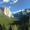
Yosemite's Best Trails
Epic scenery and adventures await. Summit hikes, waterfalls and more to choose from.
Epic scenery and adventures await. Summit hikes, waterfalls and more to choose from.

California Coastlines
California coastal hikes and beaches to check out.
California coastal hikes and beaches to check out.