
High Peaks & Balconies Cave, Pinnacles CA
• 5-star hike
• 2 to 9 mile options
• Moderate | Gain 400 to 1,890 feet
• Paicines, CA | San Francisco Region
.
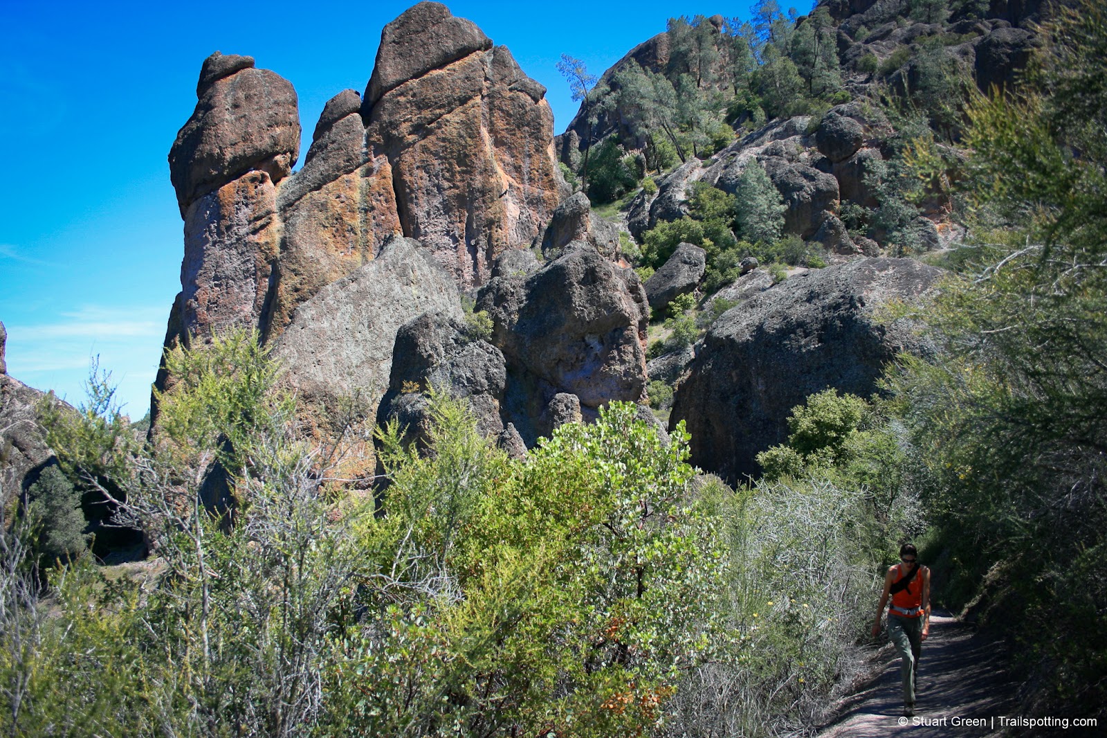
The signature rock spires on the Western side of Pinnacles.
The striking terrain of the Pinnacles National Park might make you feel like you're at least a couple of state lines distant of the San Francisco Bay Area, but in truth this national park is less than a hundred miles south of San Jose. Our featured route combines two of the most popular trails on the West side of the park, boasting caves, some tight squeezes in high places and to top it all off, the chance to see the endangered Californian condor.
High Peaks trail rises among strange rock formations, the erosional remains of a twenty-three million year old volcano, and provides great views across both the Salinas Valley and the San Andreas Rift Zone. Up here you're sharing the scenery with vultures, eagles, falcons and if you're lucky, the Californian condor with its nine-foot wingspan. Areas of the High Peaks do involve negotiating some tight spaces and narrow rock-bordered trails, but safe passage is assured with substantial guardrail protection.
| ⬤ 5★ High Peaks & Balconies Loop
GPX File · AllTrails · Directions GPX? |
| ⬤ 5★ High Peaks Part-Loop
GPX File · AllTrails · Directions |
| ⬤ 4★ Balconies Cave Part-Loop
GPX File · AllTrails · Directions |
| $ NPS entrance fee |
The route next descends to the Balconies Cave where the majority of the elevation change is now behind you. Follow Chalone Creek to the caves, which were created by a rockfall when the hillside now known as the Balconies collapsed into the valley. Use your flashlight (you did remember to bring your flashlight didn't you?) to negotiate the pitch-black cavities beneath the huge boulders as you clamber up, over and squeeze through the caverns. Passage is safe and relatively easy – anyone taking this eight mile route will have no problems with the caves. However, an alternative but slightly longer above-ground route is available if you prefer or if you forgot that flashlight.
⬤ High Peaks & Balconies Loop
This route links the heady heights of High Peaks with the Balconies Cave but also traces a route across Pinnacles mountain ridgelines and along the West Fork Chalone Creek. If you're looking for a longer trail then this is certainly worth the shoe leather. Alternatively you can hike the following two trails individually from the Western parking lot and still experience both of the main features.

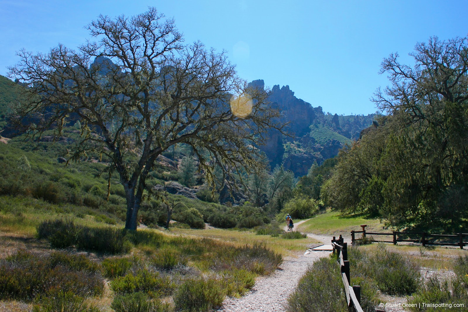
The highs and lows of the Pinnacles National Park's trails.
⬤ High Peaks Part-Loop
High Peaks was for us the main highlight of the park. This route is part out-and-back and part loop and spends most of its time within the parks distinctive rock spires. The trail also features a long man-made tunnel through solid rock to complete the looping section of trail, that you wouldn't visit if you did the combined High Peaks and Balconies route above.
⬤ Balconies Cave Part-Loop
Just the talus Balconies Cave for those who want to avoid the heights, though be aware that this route still requires some rock scrambles. Head Northeast from the Chaparral parking area and enjoy the views of the 0.7 mile out-and-back section of trail along Chalone Creek before reaching the caves. Check to make sure the caves are not flooded before you set out.
The great views start at the parking lot!
The trailhead for all of these trails is only accessible from the Western entrance of the park close to the US-101, and a day-use fee is payable. Summer conditions can be fierce on hikers in this park, so plan to tackle this park in cooler weather and remember to bring sun protection and plenty of water. Also remember to check the park's website to see if the Balconies Caves are flooded, and to check for trail closures in the winter to spring nesting seasons. Unusually, there's also a restroom on top of High Peaks.
Pinnacles is a park of two distinct sides with no roads connecting its Eastern and Western sections. This article describes the best trails available from the Western entrance. For more about the excellent trails available from the other park entrance, check out our review of the 1.8 mile Rim Trail and Bear Gulch Caves route.

A massive Californian Condor alighting from Pinnacle rocks.

Ridgeline views on the High Peaks and Balconies Cave Loop.
Tangents:
• Official: National Park Service
• AllTrails Public Map: High Peaks & Balconies
• Facebook Group: Comment, Follow Us

Best Trails of California
See our favorite hiking trails for each region of California.
See our favorite hiking trails for each region of California.

San Francisco Best Trails
For great hiking trails throughout the region, check these out.
For great hiking trails throughout the region, check these out.
Joshua Tree's Best Trails
The hikes around Joshua Tree National Park reviewed and categorized.
The hikes around Joshua Tree National Park reviewed and categorized.