
South Lykken Trail, Palm Springs CA
• 3 & 4-star hikes
• 2 to 5 mile options
• Moderate | Gain 580 to 1,090 feet
• Palm Springs, CA | Southwest US Region
.

Looking out over Palm Springs from the South Carl Lykken Trail.
The South Lykken Trail ascends a thousand feet above Palm Springs and the Coachella Valley among desert wildflowers, cacti and maybe even a bighorn sheep if you're lucky enough. Named for a local conservationist and hiking enthusiast, this trail offers stunning views of the city below and mountains beyond.
We've mapped out three options from which to choose, including out-and-back routes from trailhead to a couple of great viewpoints. We prefer a hike of the full route, either as a one way journey or as an out-and-back route that'll double your distance. In our case we used a ride-hailing service like Uber or Lyft so we could hike from the far end of the trail back to our parked vehicle.
| ⬤ 4★ South Carl Lykken Trail
GPX File · AllTrails · Directions GPX? |
| ⬤ 3★ Josie Johnson Vista
GPX File · AllTrails · Directions |
| ⬤ 3★ Simonetta Kennett Vista
GPX File · AllTrails · Directions |
| P Free parking |
Free roadside parking is available at both trailheads we've marked on our map. The northern location isn't actually a trailhead, but is the closest available parking spot and you'll find the actual trailhead well-signed at the end of West Mesquite Avenue. Please do not use the Tahquitz Canyon parking lot on private property at the top of West Mesquite Avenue, which is available for the paid hike that leads to Tahquitz Canyon Falls. We have a separate trail review of that hike linked at the bottom of this article.
⬤ South Carl Lykken Trail
As a one-way journey we prefer beginning at the south trailhead and hiking into the hills in the direction of Palm Springs. Not only does this afford excellent views of the mountain and the valley panorama below, but it also breaks down the thousand foot of elevation into a more gradual two-stage ascent. Approaching from the north requires you to tackle the full climb head on. Not that that's much of a problem though, as the trail has only a moderate incline and involves no large steps or rock scrambling.
Compared with the desolation of the desert below the foothills around Palm Springs are resplendent with vegetation including several cacti species, a variety of bushes and grasses, and between November and April expect to find wildflowers scattered over the hillsides. The trail offers no protection from the desert sun, so be sure to time your hike appropriately and pack sunscreen and plenty of water.

A steady climb from South Lykken Trailhead.
⬤ Josie Johnson Vista
The closest trailhead to Palm Springs leads you on a thousand-foot climb up the Josie Johnson Vista Park, a small mountain lookout spot that features several picnic tables. On the way, peer down into Tahquitz Canyon where you can see people on the 1.7 mile loop trail to Tahquitz Canyon Falls. Though the hike to the Josie Johnson viewpoint doesn't feature any waterfalls, it does offer a spectacular overview of the sprawling city of Palm Springs and the Coachella Valley.
⬤ Simonetta Kennett Vista
The shortest of the three hikes also requires the least amount of elevation gain, but still offers some great views from the Simonetta Kennet Vista viewpoint. Situated south of the city, the viewpoint includes a couple of picnic tables and is a great place from which to watch the sun set and for the mountain to cast it shadows over the valley. Of course, remember to bring a headlamp if you're hiking in the evening for the return trip back to the trailhead.

No steep drop-offs. This hillside trail offers comfortable hiking.

A gecko sunning itself on the rocks.

Spectacular panoramic views from the South Lykken Trail.
Tangents:
• Trail Links: Official
• AllTrails Public: S Lykken
• Facebook Group: Comment, Follow Us
• Trailspotting Nearby: 4★ Tahquitz Canyon Falls (2 mi)
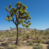
Joshua Tree's Best Trails
The hikes around Joshua Tree National Park reviewed and categorized.
The hikes around Joshua Tree National Park reviewed and categorized.

Trailspotting the Southwest
See our growing collection of hikes from the Southwestern US states.
See our growing collection of hikes from the Southwestern US states.
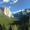
Yosemite's Best Trails
Epic scenery and adventures await. Trailspotting's Best Trails of Yosemite is a great place to start.
Epic scenery and adventures await. Trailspotting's Best Trails of Yosemite is a great place to start.


