
The Nipple, Blue Lakes CA
• 4-star hikes
• 6 mile out-and-back
• Moderate | Gain 1,230 ft | Peak 9,342 ft
• Markleeville, CA | Lake Tahoe
.

Well .. what else would you name this peak?
Not the first anatomically named mountain peak we're sure, but The Nipple is definitely a standout and a memorable trek in the Humboldt-Toiyaboe National Forest south of Lake Tahoe.
The quickest way to steal second base on this mountain is to journey up the famed Pacific Crest Trail from its intersection with Blue Lakes Road. Initially weaving through light evergreen forest, you'll gain only 400 feet of elevation for each mile, making this gradual hill climb a modest one. Views open up pretty quickly along the trail with rocky Sierra Nevada peaks as far as the eye can see, alpine wildflowers in summer, and lakes on both sides of the ridgeline.
| ⬤ 4★ The Nipple
GPX File · AllTrails · Directions GPX? |
| P Free parking |
The spur trail off the PCT that leads to the mountain's summit is located after you've passed the peak. Our map should help you locate it, particularly as on this desolated summit a defined trail can be difficult to find at times. There are some small rock scrambles required to reach the summit, including a final fumble if you want to reach the very top. While you're up there, why not add something to the "nipple thoughts" register?
This trail is popular with campers from the Lower Blue Lake Campground managed by PG&E as the peak is prominently visible from the lakeside camp sites. We hiked this trail while staying at Lower Blue Lake campground and converted it into a 10 mile loop route, however we wouldn't recommend it as this option requires over three miles of pavement pounding through the campgrounds of Upper and Lower Blue Lakes. The out-and-back route is shorter and offers better views both ways.
You can often find packed snow near the summit well into summer but at that time of year it's unlikely to cause any issues for hikers. Blue Lakes road is not accessible in winter months. Check the closure status from Alpine County website to find out whether you can drive to the trailhead.

Lost Lake to the North, as viewed this hike's summit.

Hardpacked, well-defined trail. | What are your Nipple thoughts?

Camping at Lower Blue Lake with The Nipple above.
Tangents:
• Camping: Lower Blue Lake Campground
• AllTrails Public: Nipple Trail

Trailspotting Nearby
5★ RoundTop (5-10 mi) ·
5★ The Potholes Swimming Hole (1 mi) ·
4★ Echo Lakes (6 mi) ·
Show Map
5★ Round
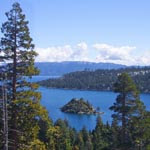
Lake Tahoe's Best Trails
All-year-round fun at this Northern California landmark. Trailspotting has Lake Tahoe hikes for everyone.
All-year-round fun at this Northern California landmark. Trailspotting has Lake Tahoe hikes for everyone.

Best Trails of California
See our favorite hiking trails for each region of California.
See our favorite hiking trails for each region of California.