
Feather Falls, Plumas National Forest CA
• 4-star hike
• 7 mile loop
• Moderate | Gain 1,100 feet
• Quincy, CA | Plumas Region
.

Standing at the observation platform of Feather Falls offers an awe-inspiring experience—gazing directly down a 640-foot cascade as water plummets over sheer granite to the valley below. This spectacular waterfall, one of the tallest in the United States, rewards hikers who venture through Plumas National Forest on the Feather Falls National Scenic Trail loop.
The main trail leads to a sturdy observation platform providing panoramic views of the thundering waterfall. For more adventurous visitors, an additional short trail leads to the very precipice of the falls, offering an even more dramatic perspective. Safety fencing exists at viewpoints, but visitors should exercise extreme caution—several fatalities have occurred when hikers ventured into the stream and were swept over the edge.
| ⬤
4★ Feather Falls Trail
GPX File · AllTrails · Directions GPX? |
| P Free parking |
The 2021 Dixie Fire dramatically transformed this landscape. What was once a dense, shaded forest journey now reveals a stark, recovering ecosystem. Despite this devastation, the Forest Service completed comprehensive trail restoration in 2024, rebuilding bridges and observation platforms to safely reopen the area to visitors.
The lower section of the loop features interpretive elements highlighting the area's cultural significance. Ancient bowl-shaped depressions in the rock, created by Maidu Indians over a millennium ago, served as mortars for grinding acorns. The trail also showcases impressive views of Bald Rock Dome (called "Earth-Maker" by the Maidu), a formation reminiscent of Yosemite's Half Dome that rises 2,000 feet above the Middle Fork Feather River.
While the falls remain impressive year-round, spring visits coincide with peak snowmelt, when the waterfall reaches its most powerful state. This season also brings a spectacular display of diverse wildflowers blooming along the entire route, adding vibrant color to the recovering landscape.

Looking back along the Middle Fork Feather River canyon.

Looking out from the falls. | Longer Feather Falls view.
Tangents:
• Official: Forest Service
• AllTrails Public: Feather Falls Trail
• Facebook Group: Comment, Follow Us
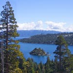
Lake Tahoe's Best Trails
All-year-round fun at this Northern California landmark. Trailspotting has Lake Tahoe hikes for everyone.
All-year-round fun at this Northern California landmark. Trailspotting has Lake Tahoe hikes for everyone.

Lassen Volcanic National Park
The park's Best Hikes include every type of volcano!
The park's Best Hikes include every type of volcano!

Best Trails of California
See our favorite hiking trails for each region of California.
See our favorite hiking trails for each region of California.


