
Mount Dana, Yosemite CA
• 5-star hike
• 5 mile out-and-back
• Hard | Gain 3,070 ft | Peak 13,053 ft
• Lee Vining, CA | Yosemite Region
.

Yosemite views from the flanks of Mount Dana.
Situated on the Eastern edge of Yosemite National Park, you're unlikely to find the Mt. Dana Summit Trail on your National Park Service map. What you will find on this trail however, is a challenging trip up the second highest peak in Yosemite National Park which rewards with some of the best panoramic views you'll experience anywhere.
Located just outside the eastern entrance to Yosemite, the staff at the Tioga Pass ranger station will be happy to point out the unmarked trailhead for you. The trail quickly transports you away from the RV traffic of Route 120 and into an evergreen forest hiding lakes and wildflowers. After half a mile the trees thin out to nothing, so be sure to check the weather forecast with rangers before you set out, as it's just you and the elements all the way to the top.
| ⬤
5★ Summit Trail
GPX File · AllTrails · Directions GPX? |
| $ NPS entrance fee* |
The well defined trail gets you close to the peak before branching off in many directions. At this point you'll have the summit in your sights so you can take your pick of trails as you navigate your way upward over and around the rocky terrain. Expect your trail to disappear beneath the small boulders from time to time, forcing you to scramble your way up. Views on the way up are spectacular, but until you reach the summit you haven't seen the half of it!
Tackling three thousand feet in under three miles might seem like a daunting challenge, particularly compounded with the extreme elevation, but if you're acclimatized to the atmosphere and if you progress at a steady pace that you're comfortable with, you'll be amazed at what you can achieve. Be sure to understand the prevention and signs of altitude sickness before you set out on the trail.
* Though the trailhead and parking area is located just outside Yosemite National Park, the majority of the trail is within the park and therefore requires payment of an entrance fee. Since there is no requirement to display proof of payment on your parked vehicle or carry proof of payment with you within the park you could possibly complete this hike without paying the entry fee. However, we always pay the entrance fee or buy the interagency annual pass in support of the National Park Service and other government maintained lands.
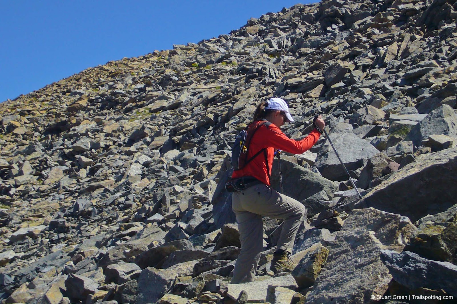
Leg burning rocks and boulder navigation to the summit.
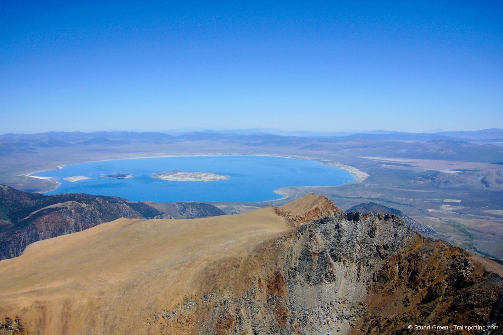
Superb views of Mono Lake from the summit.
Tangents:
• Official: Yosemite National Park
• AllTrails Public: Mt Dana
• Facebook Group: Comment, Follow Us

Trailspotting Nearby
4★ Cathedral Lakes (8 mi) ·
4★ Mono Lake Tufa Trail (1 mi) ·
5★ Half Dome (16 mi) ·
Show Map

Yosemite's Best Trails
Epic scenery and adventures await. Summit hikes, waterfalls and more to choose from.
Epic scenery and adventures await. Summit hikes, waterfalls and more to choose from.

Best Trails of California
See our favorite hiking trails for each region of California.
See our favorite hiking trails for each region of California.