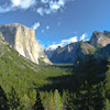
Half Dome, Yosemite CA
• 5-star hike
• 16 mile out-and-back
• Hard | Gain 4,800 ft | Peak 8,836 ft
• Yosemite, CA | Yosemite National Park
.

Arrive early to avoid crowded the crowded cable section.
It's difficult to approach Yosemite's epic Half Dome without a sense of trepidation. Perhaps it's the scale of the fifteen-and-a-half mile hike and 4,800ft elevation gain. Perhaps it's a fear of heights and worry over the final ascent of the cables, almost a mile above the valley floor. Alternatively, maybe it's just the dread of the Yosemite crowds compounded by the draw of Half Dome itself.
Thankfully the permit required to tackle this hike keep the crowds at bay, unlike some of our photos in this article that show what it was like before the permit process was put in place. See the official link at the bottom of the page for more details about arranging your permit. The cable route is usually open between May and October; again, check the links below.
Regardless, an early start is essential to mounting an attempt on Yosemite's crowning glory and sunrise is a great time to set off. Alternatively, consider a night-time ascent that concludes with a pre-dawn summit. This is something we have enjoyed in the past, on a day close to a full moon which meant that we rarely needed to use our headlamps on the trail. Experiencing the sunrise from the summit as Half Dome casts its giant shadow over Yosemite Valley is a sight to remember.
| ⬤ 5★ Half Dome Route
GPX File · AllTrails · Directions GPX? |
| $ NPS entrance fee |
The trail officially begins at Happy Isles Trailhead, though if you're arriving by car you'll be parking in the lot opposite Upper Pines Campground around half a mile away. Our 15.5 mile measurement includes the walk from the parking lot.
Begin on the John Muir Trail then continue on the Mist Trail as it follows the Merced River up into the hills behind Half Dome. Climbing a combination of steps and switchbacks lead you up the side of Vernal Falls and then Nevada Falls. Even in autumn months you'll struggle to find these waterfalls dry, and in winter the Mist Trail is closed due to treacherously icy conditions. From the top of Nevada Falls the trail continues, weaving upward through pine forest until you're presented with jaw-dropping views of the valley below.
Your climb continues with the switchbacks of Sub-Dome before tackling the final ascent up the exposed granite monolith of Half Dome. This section looks alarmingly close to vertical at first glance but in fact the angle of attack is much closer to 45 degrees. Thankfully the cable-and-post system initially erected by the park back in the 1920s makes the climb relatively manageable. Despite having a slight fear of heights we managed the cables with only mild discomfort.
 Views of Yosemite Valley over 4,000 feet below.
The final ascent of Half Dome should always be approached with caution - slick granite curves away from you on both sides of the post-and-cable route. Do not climb out of season when the cable posts have been removed. Do not climb if rain is forecast or if the granite is wet and slippery. Wear gloves and footwear with a high level of grip. The most risk averse hikers may want to consider a harness and carabiner system to tether themselves to the cable. Please take your precautions and preparations seriously to avoid becoming one of the very occasional but still too frequent fatalities that result from slips and falls from the Half Dome cables.
Don't have a permit? You can still hike all the way to the foot of the cables. We recommend a 3 mile round trip to Vernal Falls (1,040ft) or a continuation up to Nevada Falls. We have a separate Mist Trail to Vernal & Nevada Falls trail review.
 Sub-Dome switchbacks on a very busy day.
 Vernal Fall from Mist Trail. | Paved John Muir Trail segment.
 Quiet cables with a dawn ascent & return.
 Half Dome's summit rewards with spectacular views and photo-ops.
Tangents:
• Official: Half Dome, Opening Dates
• AllTrails Public: Half Dome Route
• Facebook Group: Comment, Follow Us

Yosemite's Best Trails
Epic scenery and adventures await. Summit hikes, waterfalls and more to choose from.
Epic scenery and adventures await. Summit hikes, waterfalls and more to choose from.

San Francisco Bay's Best Trails
For great hiking trails throughout the Bay Area check these out.
For great hiking trails throughout the Bay Area check these out.

Lake Tahoe's Best Trails
All-year-round fun at this Northern California landmark. Trailspotting has Lake Tahoe hikes for everyone.
All-year-round fun at this Northern California landmark. Trailspotting has Lake Tahoe hikes for everyone.


